Madagascar Weather & Climate by Region 2026: A Complete Guide
Affiliate disclosure: This article contains sponsored links to hotels, tour operators, insurance providers, and other travel services. We earn a small commission if you book through our links, at no extra cost to you.
Madagascar Weather & Climate by Region 2026 — At a Glance
- Central highlands (Antananarivo): Cool and temperate; cold winters (Jun–Aug), mild wetter summers — pack layers
- East coast & rainforests: Wettest and most humid; rain possible year-round; cyclone-prone — dry-season visits only
- West & southwest: Hot and much drier; short wet season — often travellable when the east is not
- North (Nosy Be, Diego): Warm and tropical; long dry season; whale sharks Oct–Dec — prime beach climate
- Deep south: Semi-arid and hot; low rainfall year-round — defined by heat, not the wet/dry divide
- Overall best window: The dry season (April–November) is reliable across every region
- Flight protection: EU261 €600 per passenger on disrupted European inbound flights
- Travel insurance: SafetyWing Nomad Insurance — essential in any region
- Where to stay: Madagascar stays on Agoda
Madagascar is so large — over 1,500 km from north to south — that it has no single climate. Instead it has several sharply different regional climates, shaped by altitude, the Indian Ocean, and the mountainous spine that splits the wet east from the dry west. Understanding these regional patterns is the key to planning a Madagascar trip well: the “best time to visit” can shift by region, and a month that’s washed out on the east coast may be perfect in the southwest. This guide breaks down the climate of each major region — temperatures, rainfall, seasons, and what it means for your trip — so you can match your route and dates to the weather. For the month-by-month overview and the best time to visit overall, start with our best time to visit Madagascar pillar.
The single most important pattern to grasp: Madagascar’s central mountainous spine divides the island climatically. The east, facing the moisture-laden Indian Ocean trade winds, is wet, humid, and cyclone-prone; the west and south, in the rain shadow, are much drier; and the highlands in between are cooler and temperate. Overlaid on this is the universal seasonal rhythm — a dry season (roughly April to November) and a wet season (December to March) — but its intensity varies enormously by region. The dry season is the reliable travel window everywhere; the regional differences tell you where to go when. Once you grasp this east–west, highland–lowland framework, the rest of Madagascar’s weather falls into place, and planning a trip around it becomes far more intuitive.
The Central Highlands
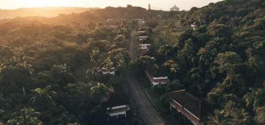
The central highlands, home to the capital Antananarivo and the historic towns of Antsirabe and Fianarantsoa, sit at altitude — Antananarivo is around 1,280 m — which gives them a cool, temperate climate quite unlike the tropical coasts. This is the Madagascar that surprises first-time visitors expecting uniform tropical heat across the whole island.
Dry season (April–November): Cool to mild days and cold nights, especially in the depths of the highland winter (June–August), when temperatures can drop close to freezing at night and frost is possible in the higher areas. Days are clear, sunny, and pleasant — ideal for sightseeing and travel — but the cold after dark genuinely surprises the unprepared. Pack warm layers, a fleece, and something for the evenings.
Wet season (December–March): Warmer and considerably wetter, with afternoon thunderstorms common. The highlands get real rain but rarely the extremes of the east coast, and cyclones are far less of a direct threat here than on the coast. Travel remains possible but less reliable, with greener landscapes as the reward.
In practical terms, dry-season daytime temperatures in the highlands sit pleasantly in the high teens to mid-20s°C, while winter nights can fall to single digits or near freezing. Because Antananarivo is the country’s main international gateway and the start of the classic RN7 route south, almost every itinerary begins and ends in the highlands — so even beach-bound travellers pass through this cooler climate and should pack accordingly. The highlands are, in effect, the climatic heart of the island and the hub through which most journeys flow.
The East Coast and Rainforests
The east coast — including the rainforest parks of Andasibe and Ranomafana, the island of Île Sainte-Marie, and the remote Masoala Peninsula — is the wettest, most humid, and most cyclone-exposed region of Madagascar. Facing the Indian Ocean trade winds head-on, it catches the moisture they carry, and rain is possible here in any month of the year.
Dry season (April–November): “Dry” is relative on the east coast — it still sees more rain than the rest of the island — but conditions are far better than in the wet months, with warm, humid days and the best access to the rainforest reserves. This is also when the humpback whales arrive off Île Sainte-Marie (July–September), making the dry season the only sensible time to plan an eastern trip.
Wet season (December–March): The east bears the full brunt of Madagascar’s wet season. Heavy, frequent rain, very high humidity, and the peak of cyclone risk (January–March) combine to make travel difficult and at times dangerous, with roads washing out and remote areas cut off. The rainforests are lush and the amphibians and reptiles highly active, but for most travellers the eastern wet season is the season to avoid. If the east is on your itinerary, time it firmly to the dry months.
The east’s defining feature for travellers is humidity: it’s warm and sticky even in the dry season, and the rainforest reserves can be wet underfoot at any time of year. Road access is the other consideration — the routes to the eastern parks and to the coast can deteriorate quickly in the rains, and reaching remote Masoala is challenging at the best of times. But the rewards are unmatched: the indri and other lemurs at Andasibe, the biodiversity of Ranomafana, and the whales off Sainte-Marie all live in this green, water-rich belt. Time it right and the east is extraordinary; time it wrong and it can be a frustrating washout.
The West and Southwest
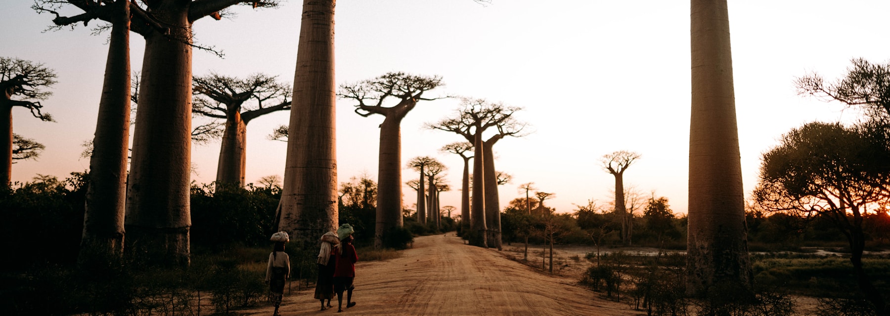
The west and southwest — Morondava and the Avenue of the Baobabs, the Tsingy de Bemaraha, Isalo National Park, and the coastal town of Tuléar (Toliara) — lie in the rain shadow of the central highlands and are markedly hotter and drier than the east. This is the region of baobabs, dry deciduous forest, and big skies.
Dry season (April–November): Hot, dry, and reliably sunny, with very little rain. The west is at its best in these months, with excellent access to the baobabs, the Tsingy, and Isalo’s canyons. It gets progressively hotter towards the end of the dry season (October–November), when the lowlands can become very warm indeed ahead of the rains.
Wet season (December–March): The west has a shorter, less intense wet season than the east. Rain comes in bursts rather than the relentless eastern downpours, and while some roads (notably the rough tracks to the Tsingy) can become impassable, the region is often still travellable when the east is a washout. For a wet-season trip, the west and southwest are the safer bet — a key piece of regional knowledge.
The west’s heat is its defining feature: by the end of the dry season the lowlands around Morondava and Tuléar can be genuinely hot, and midday in October or November calls for shade, water, and an early start to activities. The region’s roads are the other big factor — the famous tracks to the Tsingy de Bemaraha are rough dry-season-only routes that the rains can close entirely, so timing a Tsingy visit to the dry months is essential. In return, the west offers Madagascar’s most iconic image, the Avenue of the Baobabs at sunset, and the surreal limestone pinnacles of the Tsingy, both at their best under dry-season skies. Browse Madagascar stays on Agoda to plan a western circuit.
The North
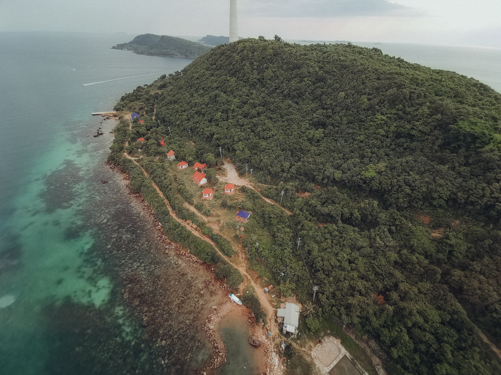
The north — centred on Nosy Be, the Diego Suarez (Antsiranana) area, and the Amber Mountain — has a warm, tropical climate and is one of Madagascar’s premier beach and diving regions. Its weather has its own rhythm, somewhat distinct from the rest of the island.
Dry season (April–November): Warm, sunny, and largely dry, with excellent beach and dive conditions through a long window. The seas around Nosy Be and Nosy Tanikely are at their calmest and clearest, and from around October the whale sharks arrive, adding a seasonal highlight. The north is a superb dry-season destination and a favourite for coastal trips.
Wet season (December–March): Hotter and wetter, with rain and some cyclone risk, though Nosy Be is somewhat sheltered compared with the open east coast. Conditions for the beach and water are reduced, and the dry season is firmly the time to come. The north’s long, reliable dry season is a big part of why it’s so popular for beach and dive holidays.
Nosy Be, reached by a short flight or a road-and-ferry connection from the mainland, enjoys one of the most benign climates in Madagascar — warm, sunny, and sea-cooled — which is exactly why it anchors so many beach itineraries. The wider north around Diego Suarez adds dramatic landscapes (the Amber Mountain, the Tsingy Rouge, the bays) that are best explored in the dry months when the tracks are firm. For a sun-and-sea trip, the north offers the widest weather window of any region, comfortably from April well into December.
The Deep South
The deep south — Fort Dauphin (Tôlanaro), the spiny forest, and the arid far south — has a semi-arid climate defined more by heat and aridity than by the wet/dry divide that governs the rest of the island. This is Madagascar’s driest, harshest, and most remote region, home to the otherworldly spiny forest and its remarkable endemic plants found nowhere else on earth.
Year-round: Hot and dry, with low rainfall in any season and long periods of drought. The south doesn’t experience the dramatic wet-season transformation of the east; instead it stays arid and warm throughout, though Fort Dauphin on the coast is greener and wetter than the deep interior. Cyclones can occasionally affect the southeast coast around Fort Dauphin during the storm season. The south is travellable across much of the year, but it’s remote and demanding, and its searing heat is the main climatic consideration.
For travellers, the deep south is the most logistically challenging region — distances are vast, roads are poor, and the heat is relentless — which is why it sees fewer visitors than the headline circuits. Those who make the effort are rewarded with genuinely unique landscapes: the spiny forest with its alien octopus trees and baobabs, found nowhere else on earth, and the dry-adapted lemurs and reptiles that live among them. Because the south’s climate is governed by aridity rather than a sharp wet season, the timing question here is less about avoiding rain and more about managing heat and the long overland distances — a region best approached with a well-planned route and plenty of time.
Best Months to Visit Each Region
Because the climate differs so much, the ideal window shifts from region to region. A quick guide to when each is at its best:
- Central highlands: April to November, with the cool, clear winter (June–August) excellent for sightseeing — just pack for cold nights.
- East coast & rainforests: July to October for the best of the dry season and the whale season (July–September off Île Sainte-Marie). Plan an eastern trip firmly within these months — see our whale watching guide.
- West & southwest: April to November, with the baobabs, Tsingy, and Isalo all at their best; even part of the wet season can work here.
- North (Nosy Be): April to December for beach and dive weather, with whale sharks from around October. The longest reliable window on the island.
- Deep south: Travellable much of the year given its aridity, though the heat peaks October to December; cooler months are more comfortable.
Wildlife viewing across all regions peaks in the dry season, and especially September to November as the lemur births begin — see our national parks and reserves guide for where to time your wildlife stops. For a beach-focused trip, the north and northwest hold their conditions longest; browse the Madagascar beaches guide to pair the right coast with the right month.
Sea Temperatures and Coastal Conditions
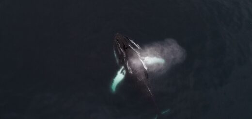
For beach, snorkelling, and diving trips, the sea matters as much as the sky. Madagascar’s coastal waters are warm year-round — typically in the mid-20s°C — and rarely cold enough to deter swimming in any season. What changes is the state of the sea: the dry season brings calmer water and better visibility, especially in the north and northwest around Nosy Be, while the wet season churns up rougher seas and reduces underwater clarity with run-off. The east coast is generally rougher and less protected than the sheltered northwest, which is one reason the north is Madagascar’s premier beach and dive region. For diving specifically, the calm, clear dry-season window (roughly April to December in the north) is when visibility is at its best, and the whale sharks off Nosy Be from October to December add a spectacular seasonal draw. Whatever the water conditions, confirm your travel insurance covers your planned water activities.
How Altitude Shapes the Climate
Beyond the east–west and north–south patterns, altitude is the third great driver of Madagascar’s weather, and it explains why the island is cooler than its tropical latitude suggests. The high central plateau keeps Antananarivo and the highlands temperate and gives them genuinely cold winter nights, while the coastal lowlands — east, west, and north — are warm to hot year-round. As you travel between the highlands and the coast on a typical itinerary, you can move from needing a fleece in the evening to sweltering on the beach within a day’s drive. Packing for Madagascar therefore means packing for several climates at once: warm layers for the highlands, light clothing for the coasts, and rain protection if you’re anywhere near the wet season. This altitude effect is one of the most commonly underestimated aspects of Madagascar’s climate.
The altitude gradient also explains some of the island’s biological richness: as you climb from the hot coast to the cool plateau and back down the other side, you pass through distinct climate and habitat zones, each with its own wildlife. It’s part of why a single Madagascar trip can show you rainforest, highland, dry forest, and reef within a couple of weeks — a range of ecosystems that mirrors the range of climates. Understanding the altitude story, then, isn’t just about packing the right clothes; it’s about appreciating why the island feels like several countries stitched together, climatically and ecologically alike.
What to Pack for Madagascar’s Climates
Because a single trip can cross several climates, packing for Madagascar means preparing for a range of conditions rather than one. The essentials, climate by climate:
For the highlands: Warm layers are non-negotiable, especially in winter (June–August). A fleece or light down jacket, long trousers, and something warm for evenings will save you from genuinely cold highland nights. Many first-time visitors pack only for the tropics and regret it the first cold night in Antananarivo.
For the coasts and west: Light, breathable clothing, sun protection (hat, high-SPF sunscreen, sunglasses), and swimwear. The lowlands and beaches are warm to hot year-round, and the dry-season sun is strong. Quick-drying fabrics are ideal in the humid east.
For the wet season anywhere: A good rain jacket, quick-dry clothing, and waterproof protection for cameras and electronics. In the rainforests, expect humidity and the possibility of leeches on wet trails — long socks and trousers help.
Year-round essentials: Sturdy walking shoes for park trails, insect repellent (malaria precautions apply in many areas — seek medical advice), a reusable water bottle, and a small first-aid kit. The single most important item, though, isn’t physical: comprehensive travel insurance, which matters in every region and every season given Madagascar’s remoteness.
The golden rule is layering: a trip that runs from the cold highlands to the hot coast in a few days needs a wardrobe that flexes across 20°C of difference. Pack light, but pack for the full range.
Humidity, Sun, and Day-to-Day Comfort
Beyond temperature and rain, two factors shape day-to-day comfort in Madagascar: humidity and sun. Humidity is highest on the east coast and in the rainforests, where even dry-season days can feel sticky and laundry never quite dries — it’s part of the rainforest experience, but worth preparing for with breathable clothing. The highlands and the west are far drier and more comfortable in this respect. Sun is intense across the island, particularly in the dry season and at altitude where the thinner air offers less protection; sunburn is a real risk even on cooler highland days, so sun protection is a year-round necessity rather than a beach-only concern. Travellers who plan for both — staying hydrated, covered, and sun-protected — find Madagascar’s climate comfortable to travel in for most of the dry season, across all but the most extreme regions. Early starts are a good habit island-wide: wildlife is most active and the air coolest in the first hours of daylight, before the midday heat builds in the lowlands.
The Cyclone Season by Region
Madagascar’s cyclone season runs roughly November to April, peaking January to March, but its impact is highly regional. The east coast and the north are the most exposed, taking the direct hits and the heaviest rain; the southeast around Fort Dauphin can also be affected. The central highlands feel cyclones mainly as heavy rain rather than direct strikes, and the west and southwest, in the rain shadow, are the least exposed. This regional pattern is central to wet-season planning: if you travel between November and April, favouring the west and avoiding the exposed east dramatically reduces your cyclone risk. Whatever the season, never travel without comprehensive insurance — SafetyWing Nomad Insurance covers the medical and disruption risks that matter most, and weather disruption is a real consideration in the cyclone months.
It’s worth keeping cyclone risk in perspective: serious storms are episodic rather than constant, and many wet-season travellers experience nothing worse than heavy rain. But the possibility is real enough — and the consequences severe enough — that it shapes sensible planning. Building flexibility into a wet-season itinerary, keeping an eye on forecasts, favouring the sheltered west, and ensuring your flights and insurance can absorb a disruption are the practical responses. The dry season sidesteps the issue almost entirely, which is the simplest reason it remains the recommended window for most visitors to every region.
Matching Your Route to the Weather
The practical upshot of Madagascar’s regional climates is that a well-planned route works with the weather. A classic dry-season circuit down the RN7 — highlands, Ranomafana, Isalo, and the southwest — strings together regions that are all at their best from April to November. A whale-and-rainforest trip to the east is firmly a July-to-September affair. A beach-and-dive holiday in the north shines through the long dry season. And a rare wet-season visitor is far better served focusing on the drier west than battling the eastern rains. Getting the regional timing right is what separates a smooth Madagascar trip from a frustrating one — and it’s where local knowledge pays off most.
The most common mistake is treating Madagascar as a single weather destination and picking dates without regard to region. A traveller who books a January rainforest tour because it suited their calendar, or who packs only beachwear for a trip that climbs into the cold highlands, learns the hard way that the island’s climate demands region-by-region planning. The good news is that the dry season (April–November) is a safe default almost everywhere, so a dry-season trip is forgiving even if your regional timing isn’t perfect. It’s the wet-season traveller, and anyone with fixed dates chasing a specific seasonal event, who most needs to map the regional climate carefully — and for whom getting it right matters most.
If you’re combining several regions in one trip — as most itineraries do — the art lies in sequencing them so each is caught at a good time and the long internal transfers make sense. A specialist who lives with these climates can build that sequence far better than a generic plan, weaving highlands, rainforest, west, and coast into a route that flows with the weather rather than against it — and timing each leg so you arrive in each region when it is at its very best.
Carla / Voyagiste Madagascar (plan around the regional weather)
Madagascar-resident specialist who knows the regional climates first-hand. Contact Carla directly to build a route that works with the weather — pairing your dates and interests with the regions that will be at their best, and steering you away from the wrong region at the wrong time. It’s exactly the kind of local knowledge that turns a good itinerary into a smooth one.
Frequently Asked Questions
What is the climate like in Madagascar?
There’s no single climate — it varies sharply by region. The east is wet and humid, the west and south are hot and dry, the highlands are cool and temperate, and the north is warm and tropical. A dry season (April–November) and wet season (December–March) overlay all regions.
Which region is driest?
The deep south and the southwest are the driest, with low rainfall year-round. The west sits in the highlands’ rain shadow and is much drier than the east.
Where does it rain the most?
The east coast and rainforests, which face the Indian Ocean trade winds and can see rain in any month, with a severe wet season and the highest cyclone exposure.
Is it cold in Madagascar?
In the central highlands, yes — winter nights (June–August) can approach freezing, with frost possible in higher areas. The coasts stay warm to hot year-round. Pack layers for the highlands.
Where should I go in the wet season?
The west and southwest, which have a shorter, less intense wet season and lie outside the worst cyclone exposure. Avoid the east in the wet months. See our best time to visit guide.
Do I need different clothes for different regions?
Yes — warm layers for the cool highlands, light clothing for the hot coasts and west, and rain protection near the wet season. A typical itinerary crosses several climates.
🧭 Plan Your Madagascar Route Around the Weather With Carla
The right region at the right time makes all the difference. Reach out to Carla, our Madagascar-resident specialist, to build a route that works with the regional climate — and avoids the wrong region at the wrong time.
Plan Your Trip to Madagascar
- Read the full Madagascar Travel Guide
- Explore itineraries by style and duration
- Explore the full destination guide
Where to Stay