Road Conditions in Madagascar Explained: What Every Traveler Must Know
Affiliate disclosure: This article contains sponsored links to hotels, tour operators, insurance providers, and other travel services. We earn a small commission if you book through our links, at no extra cost to you.
At a Glance — Madagascar Road Conditions
Madagascar’s roads are organised around the Route Nationale (RN) network, and their condition varies enormously — from reasonably maintained sealed sections near major cities to severely degraded, unpaved tracks in remote areas. Conditions generally worsen in the rainy season (roughly November to March), average speeds are low almost everywhere, and a 4×4 is essential for many regions. The single most important decision most travellers make is whether to self-drive or hire a car with a driver who knows the roads. For the vast majority, a local driver is the safer, less stressful, and often faster choice.
- Car & driver who knows the roads (recommended): Arrange a car and driver via Carla
- Stays in the capital: Check Antananarivo hotels on Agoda
- Guided tours & day trips: Browse Madagascar experiences on GetYourGuide
- Travel & medical insurance: Get covered with SafetyWing
Madagascar rewards the patient traveller, but its roads demand realistic expectations. Distances that look modest on a map can consume an entire day. A journey that would take three hours in Europe can take eight or nine here. Understanding why — the state of the network, the seasons, the terrain, and the hazards — is the difference between a trip that flows and one that unravels.
This guide explains how Madagascar’s roads actually work: what the RN network is, how conditions vary, when you truly need a 4×4, why average speeds are so low, and how all of this should shape your itinerary. Wherever possible we hedge toward caution, because road conditions change with the weather and with time — always verify current conditions locally before you set out.
None of this is meant to discourage you. Overland travel is one of the great pleasures of a Madagascar trip: the highland scenery, the roadside markets, the villages and the slow reveal of the landscape are half the experience. The point is simply to travel with the right expectations and the right support, so that the roads become part of the adventure rather than the thing that breaks your trip.
The Route Nationale (RN) Network Explained
Madagascar’s primary roads are the Routes Nationales — the RN network — radiating out from the capital, Antananarivo, toward the coasts and major regional towns. These are the arteries that carry almost all long-distance travel on the island. Numbered routes such as RN7, RN4, RN2 and RN6 form the backbone, with a web of secondary and rural roads branching off.
The crucial thing to understand is that an “RN” designation tells you a road is important, not that it is good. Condition varies dramatically along a single route: a road can be smooth sealed tarmac for one stretch, then deteriorate into potholes, then become unpaved gravel or dirt entirely. Some RNs are among the best roads in the country; others are notoriously slow and rough, especially the further you get from the highlands and major towns.
Sealed vs Unpaved: What “Paved” Really Means
Roughly speaking, roads in Madagascar fall into three practical categories, and the boundaries between them shift with maintenance and weather:
- Reasonably maintained sealed roads: Generally found on the busiest corridors and near major cities. These allow the highest (though still modest) speeds. Even here, expect potholes, unmarked speed bumps through villages, and occasional damaged sections.
- Degraded sealed roads: Tarmac that has broken up over time into a patchwork of holes and rough patches. Driving is slow and demanding, weaving around potholes rather than following a lane.
- Unpaved roads (gravel, dirt, laterite): Common across much of the country, especially rural, coastal and remote regions. These become slippery mud or wash out entirely in the rains, and are dusty and corrugated in the dry season. Many require a 4×4.
Because a route can shift between these categories within a single day’s drive, planning around “it’s an RN, so it’ll be fine” is a mistake. Plan around the worst stretch you’ll encounter, not the best.
The Big RN Routes Travellers Actually Use
A handful of Routes Nationales carry the majority of tourist traffic. Their general character is worth knowing before you plan:
- RN7 (Antananarivo to Toliara): The classic southern axis and the most travelled tourist route in the country. It is generally the best-maintained long-distance road, passing through the highlands and linking many of the south’s headline destinations. Even so, it is long, winding through hills, and speeds remain modest. See our dedicated RN7 road trip guide and our overview of the best of southern Madagascar along RN7 for the detail.
- RN2 (Antananarivo toward the east coast / Toamasina): A key eastern corridor to the coast, generally sealed but winding and prone to weather disruption in a very wet region.
- RN4 (Antananarivo toward the northwest): A major route toward the northwest, generally an important sealed corridor but with variable stretches.
- RN6 and northern routes: Serving the far north; condition varies and some sections are notably slower and rougher.
Beyond these, many celebrated destinations sit at the end of secondary or unpaved roads, where a 4×4 and extra time are non-negotiable. For a route-by-route look at how these link together, see our guide to the best Madagascar road trips and overland routes.
How Conditions Vary by Season
Season is the single biggest variable in Madagascar road conditions. The country has a broadly wet season (roughly November to March/April) and a dry season (roughly May to October/November), though timing varies by region and year.
In the wet season, heavy rain and tropical storms can cause flooding, landslides, washouts, and swollen river crossings. Unpaved roads turn to deep, slick mud; some routes become impassable, and remote regions can be temporarily cut off. Even sealed roads suffer accelerated pothole damage. In the dry season, conditions are generally much better and more predictable, though unpaved roads become dusty and corrugated, and the south stays rough year-round.
Whatever the calendar says, always verify current conditions locally — with your driver, your accommodation, or local authorities — before committing to a route in the shoulder months, when the picture can change quickly.
Why Average Speeds Are So Low — and How to Estimate Travel Time
New visitors routinely underestimate journeys because they plan by distance rather than by time. On Madagascar’s roads, average speeds are low almost everywhere, driven down by potholes, unpaved surfaces, winding mountain roads, villages where you must slow to a crawl, livestock and pedestrians on the carriageway, and the general need to drive defensively.
Rather than assuming a comfortable highway pace, assume a slow average and add generous buffers. A distance that looks like a few hours’ drive can realistically take most of a day. Build in stops, factor in the near-certainty of delays, and never plan a schedule so tight that a single washout or breakdown wrecks it. This is precisely where a driver who knows the roads earns their keep: they can give you a realistic time estimate and route accordingly.
Skip the guesswork: A local driver reads the road, the weather and the season for you.
When a 4×4 Is Essential
For the main sealed corridors near cities and along the best RNs, a standard vehicle can cope in the dry season. But for a great many of Madagascar’s most rewarding destinations — remote parks, coastal tracks, western and southern back roads — a 4×4 is essential, not optional.
You need one when the route is unpaved, when river crossings or fords are involved, when you’re travelling in the wet season on anything but the best roads, and whenever you’re heading somewhere remote where recovery from a bogging or breakdown would be difficult. A capable, well-maintained 4×4 with good ground clearance is the standard vehicle for serious overland travel here. If you’re weighing self-drive against a driver, our complete guide to driving in Madagascar walks through the trade-offs in depth.
The Main Hazards to Expect
Driving hazards in Madagascar are numerous, and awareness is your best protection:
- Potholes and broken surfaces: Ever-present on degraded roads; they force constant weaving and slow speeds, and can damage tyres and suspension.
- Pedestrians and cyclists: Roads double as village life. People, children and bicycles appear on the carriageway with little warning, particularly through settlements.
- Livestock and ox-carts: Zebu cattle, other livestock and slow-moving ox-carts routinely share the road, especially in rural areas — a serious hazard, above all at dusk and after dark.
- Night driving: Best avoided entirely. Poor or no lighting, unlit vehicles, pedestrians and animals, and unmarked hazards combine to make night driving genuinely dangerous. Plan to arrive before dark.
- Weather-related hazards: Flooding, mud, landslides and washouts in the wet season.
The golden rule: do not drive at night. Structure every day so you reach your destination in daylight, with margin to spare.
Breakdown, Fuel and Support Realities
Outside the main towns, the support network thins out fast. Fuel stations are reliable in major cities but become sparse in rural and remote areas, where fuel may only be available informally. The practical response is simple: fill up whenever you can, keep tanks topped off before leaving a town, and plan refuelling as a fixed part of your route rather than an afterthought.
Breakdown assistance and rapid recovery are not something you can count on in remote regions. Repairs may be improvised, parts hard to find, and mobile coverage patchy. This raises the stakes for vehicle condition (check tyres, brakes, suspension and fluids before any big drive), for carrying basics like water and a spare, and — again — for travelling with someone who knows the terrain. It also makes solid travel and medical insurance a genuine necessity, not a formality. Verify what your policy covers before you rely on it.
Cover the essentials before you set off:
How Road Conditions Should Shape Your Itinerary
Because roads are slow and unpredictable, itinerary design in Madagascar is really an exercise in restraint. The common mistake is trying to see too much: cramming distant regions into a short trip means most of it is spent in a vehicle, exhausted, and racing daylight.
Instead, plan fewer, deeper legs. Concentrate on one axis (RN7 is the natural starting point for first-timers) rather than crisscrossing the island. Overestimate every drive. Never schedule a long transfer and a full day of activities on the same day. Keep buffer days for weather and the unexpected. And where a road is genuinely bad, consider whether a domestic flight might be the sensible substitute for a punishing multi-day drive. If you’d rather leave the driving out of the equation altogether on some legs, our guide to public transport in Madagascar covers the alternatives.
Regional Notes
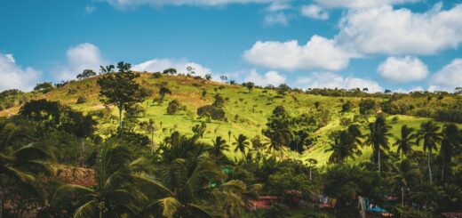
- The highlands and RN7 south: Generally the best road experience in the country, with the most maintained sealed sections — but long, winding and still slow.
- The east: A very wet region; roads are prone to weather disruption, and some access roads to eastern destinations are rough or unpaved.
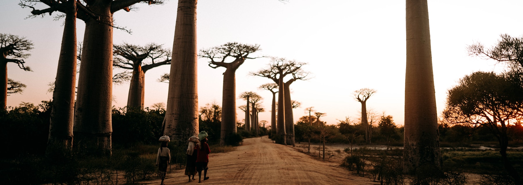
- The west and southwest: Many iconic destinations sit at the end of unpaved roads; 4×4 territory, dry-season-favouring, and often cut off or very difficult when wet.
- The far north: Mixed conditions; some corridors are slower and rougher, and remote spots require careful planning.
- The deep south: Rough and dusty year-round, with limited services over long distances.
Route Condition Quick Reference
| Route / area | General condition | 4×4? | Wet-season risk |
|---|---|---|---|
| RN7 (Tana–Toliara, south) | Mostly sealed, best long-distance road | Not usually, but useful | Moderate |
| Eastern routes | Variable; winding, weather-exposed | Recommended on side roads | High |
| Western / southwestern tracks | Often unpaved, rough | Essential | Very high |
| Remote parks & coastal access | Unpaved, slow, fords possible | Essential | Very high |
General guidance only — conditions vary by season and over time. Always verify current conditions locally.
Self-Drive vs Car and Driver
Self-driving is possible for confident, experienced overlanders who understand rough-road and 4×4 driving, and who accept the risks of remote breakdowns and difficult navigation. For nearly everyone else, hiring a car with a local driver is the smart move. A good driver reads the road and the weather, knows which stretches are currently passable, handles the hazards, avoids night driving by design, and frees you to actually enjoy the journey rather than white-knuckle it.
It is often the safer and the more efficient option, precisely because a driver’s local knowledge shaves time and avoids dead ends. A driver also knows the small things that make a long day bearable — where to stop, where fuel is reliable, which route is currently open after rain — and can adapt on the fly when conditions change. That local judgement is worth far more than it costs. Meet Carla — arrange a car and a driver who genuinely knows Madagascar’s roads.
Frequently Asked Questions
How bad are the roads in Madagascar, really?
They range widely. The best sealed corridors — notably RN7 — are reasonable, while many secondary and remote roads are degraded, unpaved and slow. The honest summary is that conditions vary enormously and generally worsen in the rainy season, so you should plan for the worst stretch on any given route rather than the best.
Do I need a 4×4 in Madagascar?
For the main sealed routes near cities and along the best RNs in the dry season, a standard vehicle can manage. But for many of the country’s most rewarding destinations — remote parks, coastal and western tracks, and almost anything unpaved in the wet season — a 4×4 is essential. When in doubt, choose the 4×4.
Why do journeys take so much longer than the distance suggests?
Average speeds are low almost everywhere because of potholes, unpaved surfaces, winding roads, villages, and livestock and pedestrians on the road. Plan by realistic time, not by kilometres, and add generous buffers — a drive that looks short can take most of a day.
Is it safe to drive at night in Madagascar?
No — avoid night driving entirely. Poor lighting, unlit vehicles, pedestrians and animals on the road, and unmarked hazards make it genuinely dangerous. Structure each day to arrive at your destination in daylight, with time to spare.
Should I self-drive or hire a driver?
Unless you’re an experienced off-road driver comfortable with remote conditions, hiring a car with a local driver is the safer, less stressful and often faster choice. A driver who knows the roads handles the hazards, judges what’s currently passable, and lets you focus on the trip. Arrange one via Carla.
If you have flights connecting to your Madagascar trip and they are delayed or cancelled, you may be entitled to compensation — it’s worth checking your eligibility with AirAdvisor.
Let a Driver Who Knows the Roads Take the Wheel
Madagascar’s roads reward local knowledge more than almost anywhere. Rather than gambling on potholes, washouts and night-time hazards, travel with a driver who reads the road, the season and the shortcuts. Carla connects you with a car and a driver who genuinely knows Madagascar — so you can watch the landscape instead of the potholes.
- Book it: Arrange your car & driver via Carla
- Questions first? Get in touch with us and we’ll help you plan.
- Don’t forget cover: Insure your trip with SafetyWing