Mobile Data Dead Zones in Madagascar: Where No Network Reaches
This post contains affiliate links. We may earn a small commission at no extra cost to you.
At a Glance
- Guaranteed dead zones: Marojejy interior, Masoala Peninsula, Kirindy forest core
- Partial signal zones: Ranomafana forest trails, Tsingy interior, southern RN13
- Best offline maps: Maps.me, Organic Maps (download before leaving last town)
- Remote area transport: Compare 4WD rentals on Carla — essential for dead zone access routes
- Emergency coverage without signal: SafetyWing covers emergency evacuation — no mobile signal required to make a claim
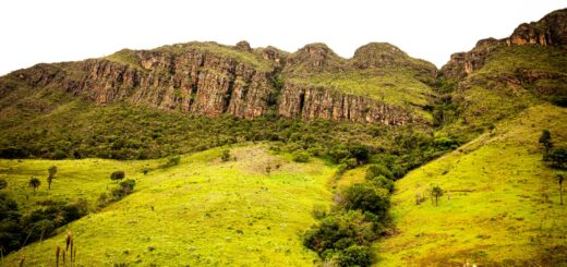
Understanding where Madagascar’s mobile networks stop is as important as knowing where they work. Dead zones coincide with the most biodiverse and remote parks — Marojejy, Masoala, and the deep western forests are the best wildlife destinations and the places with no signal. Preparing correctly for these gaps is simple; being caught unprepared in a dead zone with no offline maps, no downloaded content and no emergency contacts established is genuinely risky.
Plan your Madagascar trip:
Complete Dead Zones — Parks With No Usable Signal
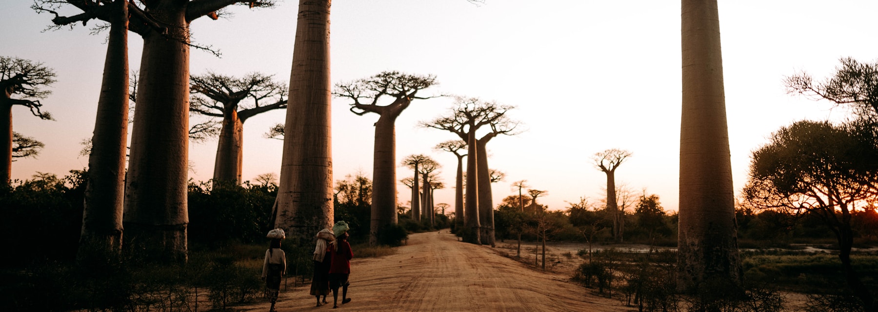
Several Madagascar parks and access routes have no usable mobile signal regardless of operator. Marojejy National Park loses all connectivity after the Manantenina River crossing at the base of the trek — the three camp system (Mantella, Marojejia and Simpona) operates entirely without mobile coverage. The trek takes 3 to 6 days depending on route and summit attempt; emergency communication requires either a satellite communicator (SPOT or Garmin inReach) or reliance on the park ranger system. Masoala Peninsula has no coverage beyond Maroantsetra town. The 3-day coastal trek to Cap Est and the lodge areas deep in the peninsula exist completely offline. Kirindy Forest interior has no usable signal — the Menabe Forest Camp is reachable from Morondava but sits in a mobile dead zone. The camp staff use a radio system for communications with Morondava town. The RN13 route from Tuléar to Fort-Dauphin through the south passes through 600km of territory with almost no mobile coverage — a route used by overland travelers doing a complete southern circuit. Remote comfort: satellite imagery confirms emergency response teams can reach any point in Madagascar within 2 to 4 hours by air from Antananarivo regardless of ground signal. SafetyWing’s evacuation coverage operates via satellite coordination, not mobile calls.
Partial Signal Zones — Where Coverage Is Unreliable
Between full coverage and complete dead zones lies a large category of partial signal areas that trip up travelers who assume their SIM is either working or not. Ranomafana National Park’s main circuit near the visitor centre has intermittent Orange 4G — enough for a map check or a short voice call but unreliable for data streaming. The upper trails above the main forest zone lose all signal. Andasibe-Mantadia has no signal inside the forest but 3G to 4G on the main RN2 road 500m from the park entrance. The Tsingy de Bemaraha main circuit area has Telma signal at the park entrance and parking area but none along the canyon circuits. Isalo National Park has signal at Ranohira village (full 4G, Orange) and along the paved road but not in the canyon interior. Understanding this pattern helps: coverage follows roads, towns and park infrastructure perimeters. Once you move 500m to 2km beyond any of these into actual forest or canyon terrain, expect zero signal. The practical implication: download all navigation content, lodging confirmation PDFs and emergency contact numbers onto the device before entering any park, not in the car park. Café stops on the RN7 frequently have Orange 3G or 4G — use these for quick downloads before the final park approach.
Read also:
Save money on your Madagascar trip:
How to Prepare for Dead Zones Before You Enter Them
Dead zone preparation has five practical components. First, offline maps: download the Maps.me or Organic Maps data packages for your specific regions before leaving Antananarivo — these include trail data for major national parks and village locations along the route. Google Maps offline mode covers paved road areas but not forest trail detail. Second, lodge confirmations: download all accommodation booking confirmations as PDFs rather than relying on email access. Third, currency: carry sufficient ariary for the entire dead zone stay — ATMs do not exist in remote parks and many lodges accept cash only. Budget approximately 80,000 to 120,000 MGA per day for park fees, guide fees and meals at remote sites. Fourth, emergency contacts: write down (on paper) the contact number of your accommodation’s main office in the last town with signal, your guide’s name and your insurance emergency number. SafetyWing’s emergency number is reachable by satellite phone if needed. Fifth, offline entertainment: download books, podcasts and video content before entering dead zones — two nights at Kirindy or Marojejy with no connectivity is an opportunity for genuine offline rest rather than a problem. If driving to remote parks, compare 4WD rental options on Carla before your route departs Antananarivo — reliable transport into dead zones is more important than connectivity within them.
Satellite Communication Options for Remote Madagascar Travel
For travelers entering complete dead zones on multi-day treks — Marojejy, Masoala, or the southern RN13 overland route — satellite communication devices provide genuine emergency capability. Garmin inReach Mini 2 is the most popular option among experienced wilderness travelers; it allows two-way text messaging via the Iridium satellite network from any location on Earth, emergency SOS coordination with GEOS emergency services, and GPS tracking that can be shared with contacts at home. The device costs approximately $350 and requires a monthly subscription ($15 to $65 depending on message volume) — activate the plan before departure. SPOT Gen 4 is a cheaper one-way alternative ($150 plus subscription) that sends GPS location check-ins and a dedicated SOS button connecting to GEOS. It cannot receive messages but functions as a reliable check-in system for solo travelers and small groups. Satellite phone rental is available in Antananarivo at specialised outdoor equipment shops near the Haute-Ville for approximately $15 to $25 per day with call costs extra. For a week-long Marojejy trek, a Garmin inReach rental from the same operators is possible at $10 to $15 per day. Park rangers at Marojejy and Masoala carry their own communication systems and maintain contact with base stations in Andapa and Maroantsetra respectively — your guide can relay emergency messages through the park system if personal satellite devices are not carried.
Ready to book your Madagascar trip?
Frequently Asked Questions
Is it dangerous to enter Madagascar’s remote parks without mobile signal?
Not inherently — millions of visitors complete remote Madagascar treks safely every year without personal satellite devices. The park ranger system provides a safety net for medical emergencies, and your guide maintains contact with base via established radio or relay systems. The risk increases significantly if you enter without a guide (illegal at all national parks), without confirmed accommodation at each camp, and without informing someone of your route and expected return date. With these basics in place, the absence of mobile signal is an inconvenience rather than a safety issue.
What offline map app works best for Madagascar’s national park trails?
Maps.me (formerly MapsWithMe) has the most comprehensive trail data for Madagascar’s national parks — including Marojejy’s three-camp system, Ranomafana’s circuit trails and the Tsingy canyon walks. Download the Madagascar data package (around 180 MB) on WiFi before entering any dead zone. Organic Maps is a lighter alternative with similar OpenStreetMap-based data. Google Maps offline covers roads and towns but not forest trails — use it for inter-city navigation and Maps.me for park interiors.
Do any of Madagascar’s national parks have emergency communication infrastructure?
Yes — all ANGAP-managed national parks have ranger stations equipped with radio communication to the park’s main administrative centre. Marojejy and Masoala have the most established emergency relay systems, as these parks receive international trekkers who regularly request evacuation assistance. Park entrance fees include access to this emergency infrastructure. Your assigned guide is the correct first contact for any emergency — they will activate the park’s communication system, which is more reliable than personal mobile signal in most remote areas.
Madagascar’s dead zones are features, not bugs — the remoteness that eliminates mobile coverage is the same remoteness that produces exceptional wildlife density. The preparation checklist is short: offline maps downloaded, ariary on hand, emergency contacts written down, insurance activated. With these four items done before leaving the last town with signal, dead zones are where the best experiences happen, not where things go wrong.
Plan Your Trip to Madagascar
- Read the full Madagascar Travel Guide
- Explore itineraries by style and duration
- Explore the full destination guide
Where to Stay
Hotels, lodges, and tours fill fast for July–September — compare availability now.