Network Coverage in Remote Madagascar: Park-by-Park Signal Map
This post contains affiliate links. We may earn a small commission at no extra cost to you.
At a Glance
- Good 4G coverage: Andasibe, Ranomafana (village area), Nosy Be, Île Sainte-Marie
- Patchy 2G/3G: Isalo (Ranohira village only), Diego Suarez town area, Toliara
- No signal in park interior: Marojejy, Masoala, Tsingy de Bemaraha, Kirindy Forest
- Best operator for national parks: Orange Madagascar (widest rural coverage)
- Offline maps essential: Download Maps.me or OsmAnd before entering any park zone
- Emergency device: Garmin inReach for parks with zero coverage
- Travel insurance: SafetyWing — covers medical evacuation from zero-coverage wilderness areas
No mobile map accurately predicts what you will experience on Madagascar’s park trails — but knowing which parks have reliable signal, which have edge-of-town coverage only, and which have zero signal lets you prepare the right backup tools before you step off the vehicle.
Plan your Madagascar trip:
Parks with Reliable Coverage: Where Your SIM Works Well
A handful of Madagascar’s most visited parks and destinations have reliable mobile network coverage, making them the easiest places to navigate without pre-downloaded offline maps. Andasibe-Mantadia: Orange and Telma both provide 3G to 4G coverage in Andasibe village and along the main RN2 road corridor. The village area around the park gate has consistent signal. Coverage drops to 2G or absent on trails deeper than 1–2 km into the park interior — download offline maps before your morning walk. Ranomafana: Coverage in the village of Ranomafana itself (near the hotel cluster) is reasonably good on Orange. Park trail coverage drops quickly beyond the park entrance. Nosy Be: Full 4G from Orange and Airtel across the island’s populated areas, including Hell-Ville, Ambatoloaka, and the main resort strip. Coverage drops in the interior of Lokobe Reserve but the reserve area is small enough that you are rarely far from signal. Île Sainte-Marie: Good 3G/4G coverage along the main coastal road and in Ambodifotatra. Interior tracks have variable coverage. Diego Suarez (Antsiranana): Good urban coverage in the city centre; coverage drops rapidly outside town toward Ankarana or the beaches. Our mobile dead zones guide maps these transitions in more detail.
Parks with Edge-of-Town Coverage Only: Plan Your Offline Strategy
The majority of Madagascar’s national parks fall into this category: coverage exists in the nearest town or at the park accommodation cluster, but disappears almost immediately once you are on a trail. This is the most important category to understand because travellers are often surprised when their SIM suddenly stops working after leaving the lodge in the morning. Isalo National Park: Orange provides 2G coverage in Ranohira village where most lodges are located. Signal on the trails — including the popular Sacred Pool route and the Natural Pool circuit — is essentially absent. Download topographic trail maps via OsmAnd and take screenshots of key route information before starting any hike. Tsingy de Bemaraha: Very limited coverage in Bekopaka village. No signal in the park itself. The Tsingy trails require a local guide (mandatory), so coordinate all logistics in the village before entering. Kirindy Forest Reserve: No reliable signal. The reserve is approximately 60 km north of Morondava. Morondava town has reasonable Orange coverage; once you turn off the main RN35 road toward Kirindy, signal disappears. Zombitse-Vohibasia: No coverage. Located on the RN7 corridor, the nearest signal is in Sakaraha town. See our operator comparison guide for detailed coverage strength by region.
Read also:
Save money on your Madagascar trip:
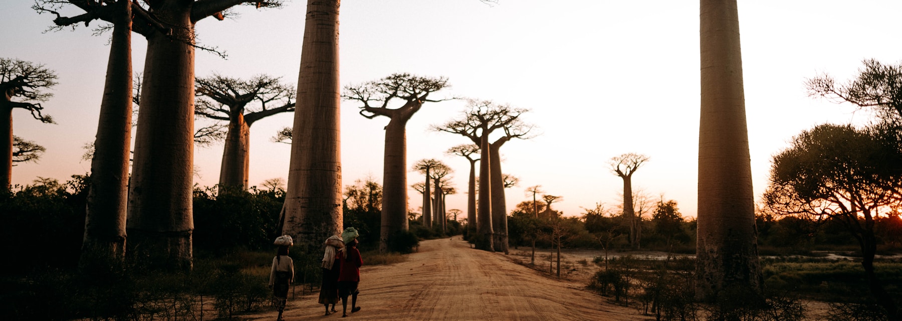
Remote Parks with Zero Coverage: Offline Preparation is Non-Negotiable
Three of Madagascar’s most spectacular wilderness destinations have no mobile coverage inside the park boundaries and very limited coverage even at the access villages. These require the most thorough offline preparation. Marojejy National Park: No signal inside the park. The base camp village of Manantenina has sporadic signal on Orange, but do not rely on it. The Marojejy trek is a multi-day expedition requiring permits, a licensed guide, and full self-sufficiency. Bring a Garmin inReach or similar satellite communicator as your emergency communication device. Masoala Peninsula: Madagascar’s largest national park has no mobile coverage anywhere in the park interior. Access is by boat from Maroantsetra (which has limited Orange coverage). All logistics — lodge bookings, emergency contacts, and route planning — must be finalised before the boat crossing. Andringitra National Park: Home to the Tsaranoro Wall rock climbing area. No signal on the high plateau. Ambalakindresy village at the park base has occasional 2G. Bemaraha region broadly: Anywhere more than 5–10 km off the RN35 in the Morondava–Bekopaka corridor should be treated as a no-signal zone. Pre-download comprehensive offline maps via Maps.me or OsmAnd and prepare all contacts before departing your last connected location.
Choosing the Right Operator for Park Travel
Not all three operators perform equally in Madagascar’s park regions. If you are planning a trip that focuses on national parks and wilderness areas, the choice of operator matters more than it does in urban travel. Orange Madagascar has the widest rural coverage footprint and is the strongest choice for travellers visiting multiple parks across the island. Orange typically has coverage in or near park gateway towns even when Telma and Airtel do not. Telma has strong coverage in the central highlands (the Antananarivo–Fianarantsoa–Ranomafana corridor) and is a reasonable second choice for highland-focused itineraries. Its coastal and western coverage is notably weaker. Airtel has the weakest rural coverage but the best urban 4G speeds in Antananarivo, and competitive pricing on data bundles. It is best used as a supplementary SIM for city time rather than as a primary travel SIM. Practical recommendation: Carry a primary Orange SIM and supplement with an eSIM from a global provider (Airalo, Holafly) as a backup for edge-of-coverage situations. This two-layer approach covers the widest range of scenarios without needing to carry multiple physical SIM cards. For full operator comparisons on speed, price, and regional performance, see our complete network comparison.
Ready to book your Madagascar trip?
Frequently Asked Questions
Which Madagascar national parks have usable 4G signal?
Andasibe-Mantadia has the best park-adjacent coverage — Orange and Telma provide 3G to 4G in Andasibe village. Ranomafana village has reasonable Orange 3G. Nosy Be’s Lokobe Reserve is surrounded by good 4G from the island’s coverage. All other major parks (Isalo, Tsingy, Marojejy, Masoala, Kirindy, Andringitra, Zombitse) should be treated as no-signal zones once you are on the trail.
Can I use Google Maps in Madagascar’s national parks?
Only if you download the offline map area before entering the park. In areas with 4G signal (near park entrances), Google Maps works in real time. Once signal drops on the trail, you need offline maps. Maps.me and OsmAnd are better than Google Maps for offline Madagascar use because their map data is more complete for jungle and mountain trails. Download your specific region before departure or at your hotel the night before.
What is the best emergency communication device for remote Madagascar parks?
The Garmin inReach Mini 2 is the most widely used option among trekkers in Madagascar’s remote parks. It provides two-way satellite messaging and SOS triggering via the Iridium satellite network, which covers Madagascar completely. Monthly plans start at $15 for minimal use (freedom plan). Alternatively, SPOT devices offer one-way SOS and location tracking at lower cost. Both are available for purchase internationally before your trip.
Understanding park-by-park signal coverage is one of the most practical preparation steps for any Madagascar wildlife trip. Download offline maps before every park visit, choose Orange as your primary SIM for the widest rural reach, and carry a satellite communicator for any remote multi-day trek. And before any wilderness trip: activate SafetyWing — medical evacuation from Madagascar’s most remote parks costs $50,000 or more without coverage, and no mobile network will help you arrange it if you are already deep in the forest.
Plan Your Trip to Madagascar
- Read the full Madagascar Travel Guide
- Explore itineraries by style and duration
- Explore the full destination guide
Where to Stay