RN7 Road Trip Guide: Antananarivo to Fort Dauphin Complete 2026
This post contains affiliate links. We may earn a small commission at no extra cost to you.
At a Glance
- Distance: 990km Antananarivo to Fort Dauphin
- Driving time: 4–5 days by 4×4 | 1h25 by Tsaradia domestic flight
- Route highlights: Antsirabe, Ambositra, Fianarantsoa, Isalo, Amboasary
- Best season: April–November (dry roads, stable weather)
- Car rental: Compare 4×4 rental rates on Carla
- Hotels in Antananarivo: Check availability on Agoda
- Travel insurance: Get SafetyWing before you drive
The RN7 is Madagascar’s most celebrated road trip — 990 kilometres of red-earth highland, canyon gorge and spiny desert before the Indian Ocean opens up at Fort Dauphin. It is not fast, it is not smooth, and it is absolutely unforgettable. This guide covers every stage, every stop and every practical detail you need to drive it confidently in 2026.
The RN7 Route: Distances, Timeline and Road Conditions
The RN7 stretches 990km from Antananarivo’s southern exit to Fort Dauphin’s coastal approach, cutting through five distinct ecological zones. Most self-drivers split the journey into four overnight stages: Antananarivo to Fianarantsoa (330km, 6–8 hours on acceptable tarmac), Fianarantsoa to Ihosy (200km, 3–4 hours including a Ranomafana detour), Ihosy to Amboasary (330km, the most demanding stretch), and Amboasary to Fort Dauphin (60km). A 4×4 is strongly recommended from Ihosy onwards — corrugated laterite and deep potholes severely punish standard vehicles south of the Horombe plateau. Fuel stations grow dangerously sparse after Ihosy: fill your tank at every opportunity and carry at least 20 litres in a jerry can. Madagascar’s national speed limit of 80km/h applies throughout, though road conditions in the south regularly enforce speeds of 30–40km/h. Build at least 30 minutes of buffer per 100km south of Ihosy into your daily schedule. Compare 4×4 rental prices on Carla — book at least two weeks ahead between June and September when demand peaks.
Flying instead of driving one direction? Tsaradia operates Antananarivo–Fort Dauphin daily. Connections often route through Tana — if your domestic leg is delayed, check your compensation claim free on AirAdvisor.
Key Stops: Antsirabe, Ambositra and Fianarantsoa
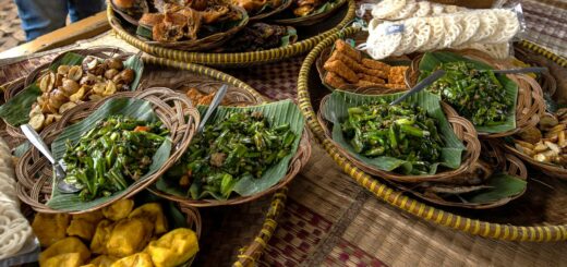
Antsirabe (170km, 2.5 hours from Tana) is the natural first overnight stop — a colonial thermal spa town at 1,500 metres known for its rickshaw culture and Ranomafana mineral water plant. Hotel Truchet and Le Trianon offer reliable mid-range comfort at 80,000–120,000 Ar per night. Ambositra (100km further south) is Madagascar’s wood-carving capital: roadside workshops produce intricate intarsia marquetry panels in rosewood and ebony at a fraction of Tana market prices. Genuine artisans cluster around the main square; factory outlets on the highway offer tourist-grade work. Fianarantsoa deserves a full day. Climb the steep Haute-Ville district for terracotta rooftop panoramas, visit Soavinandriana winery for a free tasting of Madagascar’s only commercially produced wine, and consider a half-day detour east to Ranomafana National Park (45km off the RN7) for bamboo lemurs and golden bamboo lemurs found nowhere else on earth. The Micheline train from Fianarantsoa to Manakara departs Tuesday and Saturday at 07:00 — it is one of Africa’s great rail journeys through 48 tunnels and 67 bridges across 163km. Book Ranomafana park treks on GetYourGuide to secure morning guide slots.
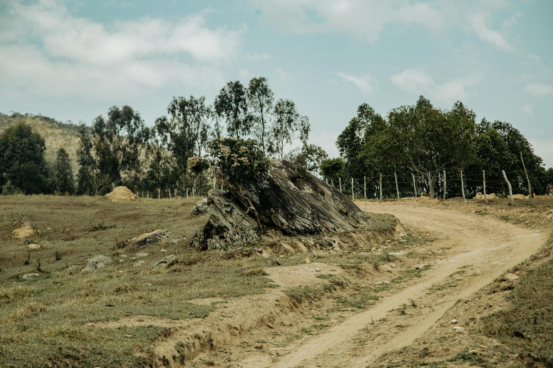
Isalo National Park and the Spiny South
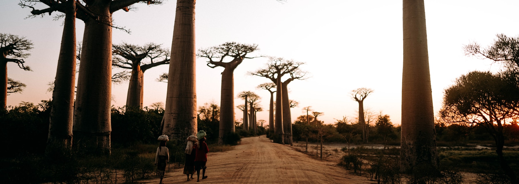
Isalo National Park, 700km from Tana, is the road trip’s centrepiece. The park’s sandstone massifs and canyon pools are best explored on a half-day or full-day guided trek. Reserve fees are 55,000 Ar (approximately $11) per person; a guide is compulsory at 20,000–40,000 Ar per group depending on trail length. The Piscine Naturelle (cold canyon pool with cascade) and Canyon des Makis are the most popular circuits. Jardin du Roy and Isalo Rock Lodge offer dramatic canyon-view accommodation — both book out months ahead between June and September. South of Isalo the RN7 enters the spiny south: Pachypodium cactus-trees, baobabs and endemic euphorbias replace highland pines. Road quality drops sharply near Amboasary — expect corrugation, drifting sand and occasional flood damage even in dry season. The last 200km to Fort Dauphin passes through Anosy territory with spectacular granite inselbergs rising from dry scrub. Book guided Isalo day treks on GetYourGuide to guarantee early morning starts with qualified guides. Pay Isalo accommodation upfront by bank transfer when booking — cash deposits are non-refundable.
Fort Dauphin: What Awaits at Journey’s End
Fort Dauphin (Tolagnaro) occupies one of Madagascar’s most dramatic settings — a narrow peninsula between the Indian Ocean and two deep bays, backed by granite mountains. The town was Madagascar’s first European settlement (French fort, 1643) and today serves as the gateway to the extraordinary Anosy region. Berenty Private Reserve (45km west, entry from $35 per person including guide) holds Madagascar’s most accessible populations of ring-tailed lemurs and Verreaux’s sifaka, reliably found dancing along the spiny forest tracks every morning. The Lokaro Peninsula, reached by pirogue from Evatra village, delivers deserted white-sand beaches and clear snorkelling without another tourist in sight. Libanona beach immediately below the old French fort ruins is Fort Dauphin’s best city swimming beach. Book Fort Dauphin hotels on Agoda — Kaleta Hotel and Libanona Beach Hotel are the most reliable mid-range options at $40–$70 per night. Fly back to Antananarivo on Tsaradia (1h25, $80–$150 depending on booking window) rather than driving north — it saves two days and your spine.
Frequently Asked Questions
Do I need a 4×4 for the full RN7 road trip?
South of Ihosy, yes — absolutely. North of Ihosy a standard car handles the tarmac in dry season, but the potholed stretches near Amboasary will damage low-clearance vehicles. A 4×4 also opens up detours to viewpoints and side routes that make the trip dramatically richer.
How long does the full RN7 drive take end to end?
Budget 4 to 5 days minimum for the drive alone, with proper overnight stops. Rushing the full route in 3 days is physically possible but leaves zero time for Isalo, Ranomafana, or any of the experiences that make the road trip worthwhile.
Is it safe to drive the RN7 after dark?
Never drive after dark in Madagascar. Unlit zebu carts, pedestrians on the road shoulder, and unmarked road damage make night driving on any national highway extremely dangerous. Always plan to reach your overnight stop at least 30 minutes before sunset.
Can I fly one direction and drive the other?
Yes — many travellers fly Tsaradia Antananarivo to Fort Dauphin on arrival, then drive north. This removes time pressure and lets you experience the road at a relaxed pace. Alternatively, drive south and fly back from Fort Dauphin — the 1h25 return flight costs $80–$150 and saves two days.
The RN7 is not just a road — it is a complete cross-section of Madagascar, from the cool highland plateau to the bone-dry spiny desert. Give it five days, carry extra fuel, and stop everywhere interesting. Before you leave Antananarivo, make sure you are properly covered: get SafetyWing travel insurance or compare it with World Nomads for adventure cover. Medical evacuation from remote southern Madagascar costs $30,000–$80,000 — coverage is not optional when the nearest hospital is four hours away on a broken road.
Plan Your Trip to Madagascar
- Read the full Madagascar Travel Guide
- Explore itineraries by style and duration
- Explore the full destination guide
Where to Stay