RN13 Road Trip: Driving Madagascar’s Southern Desert Route (2026 Guide)
This post contains affiliate links. We may earn a small commission at no extra cost to you.
At a Glance
- Route: Fianarantsoa → Ihosy → Betroka → Tsivory → Fort Dauphin (Tôlanaro) — approx. 550 km
- Road type: Paved to Ihosy, then laterite/piste from Ihosy south — 4WD essential
- Best season: May–October (dry season); wet season (Nov–April) can make sections impassable
- Recommended vehicle: Hire a Toyota Hilux 4WD via Carla — standard saloon cars will not complete this route
- Endpoint hotels in Fort Dauphin: Check availability on Agoda — book ahead in July–August peak
- Insurance: SafetyWing covers remote evacuation from $1.82/day
- World Nomads — covers adventure activities: trekking, diving, motorbikes. Compare both.
The RN13 is one of Madagascar’s most demanding and rewarding overland routes — a corridor through the island’s arid deep south that most tourists never see. Connecting the highland town of Ihosy to the coastal city of Fort Dauphin across 400 kilometres of semi-desert, scrub, and baobab-dotted laterite tracks, the route is not for the unprepared. For those who are ready, it is the closest thing to true off-grid expedition driving available anywhere in the Indian Ocean region.
Plan your Madagascar trip:
What Is the RN13 and Who Should Attempt It
Route Nationale 13 runs from the highland junction at Ihosy — where the well-maintained RN7 from Antananarivo terminates — south through Betroka and Tsivory to Fort Dauphin on the Indian Ocean coast. The total distance from Fianarantsoa (the practical starting city) to Fort Dauphin is approximately 550 kilometres, typically completed in three to five driving days in dry season.
The route is suited to experienced off-road drivers or travelers with a vetted local driver who knows the southern corridor. Navigation requires GPS with offline maps (Maps.me or OsmAnd with Madagascar data downloaded) — signage is minimal and junctions are unmarked in the southern section. A recovery kit (tow rope, high-lift jack, sand tracks or tree anchor) is standard equipment; a puncture on a remote piste section can strand a vehicle for hours without these tools.
For travelers wanting to see the south without the driving challenge, our guide to reaching Fort Dauphin compares driving against flying — domestic flights to Tôlanaro take under two hours from Antananarivo and cost $80–160 USD one way.
Flight delayed before this trip? International connections through Paris or Nairobi to Madagascar are covered by EU Regulation EC 261. If a delay caused you to miss onward travel, you may be entitled to up to EUR 600. Check your claim free on AirAdvisor.
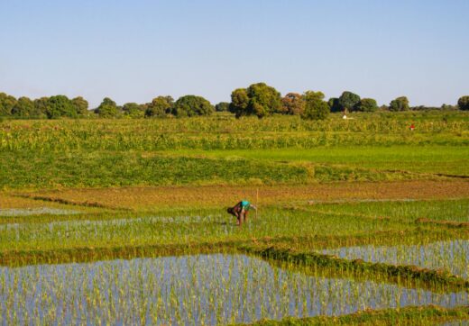
Stage 1: Fianarantsoa to Ihosy — The Last Paved Section
The 215-kilometre stretch from Fianarantsoa south to Ihosy follows the RN7 on well-maintained tarmac through highland rice paddies and cattle country. This is the most relaxed driving day of the entire circuit. Ihosy is the last town with reliable fuel stations, a functioning bank (BNI, BOA), and a choice of guesthouses before conditions deteriorate significantly south of the junction.
Refuel completely at Ihosy regardless of your tank level — the next reliable fuel supply is at Betroka (170 km south), where supply can be intermittent. Carry a 20-litre jerry can as a minimum. Stock provisions at the Ihosy market: water (at least 6 litres per person per day in the southern heat), tinned food, rice, and biscuits for roadside meals where no hotely exists.
Spend a night in Ihosy to rest before the demanding south leg. The Hotel Zaha Motel and Chez Jacqueline pension are the two most traveler-reliable options at approximately 40,000–60,000 MGA per room. Confirm your vehicle’s tyre pressures and check brake fluid before departing at dawn for Betroka.
Read also:
Book activities in Madagascar:
Stage 2: Ihosy to Betroka — Into the Desert
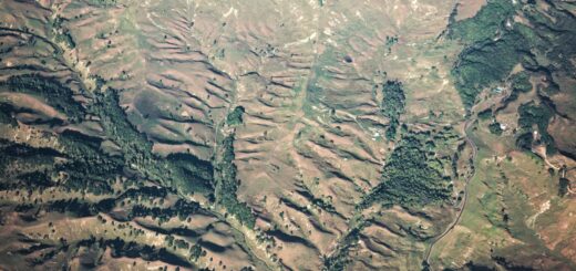
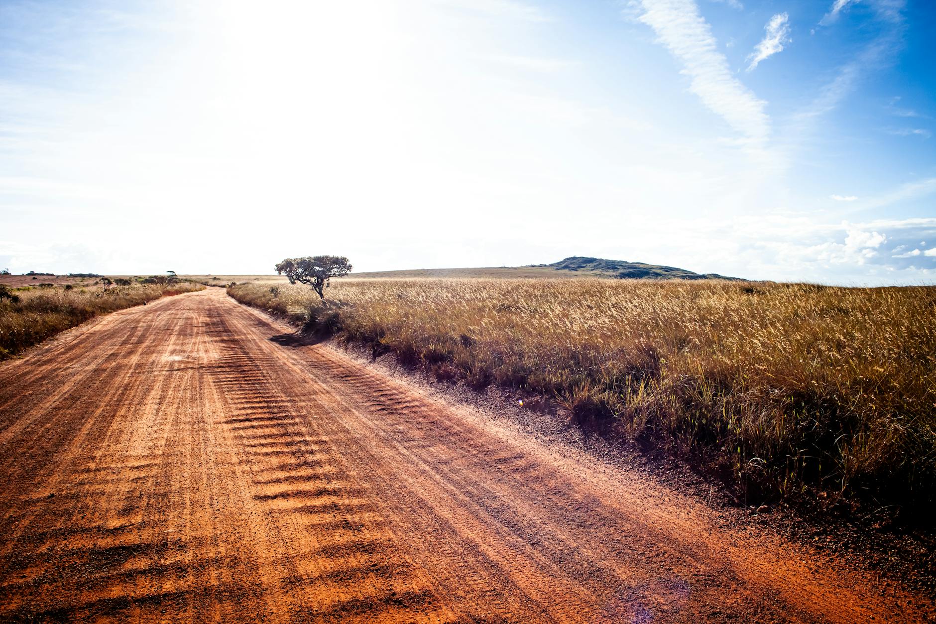
South of Ihosy, the RN13 transitions from paved road to laterite piste within the first 30 kilometres. The terrain shifts rapidly from highland to sub-arid scrub — spiny forest, cactus-like Didierea trees, and the characteristic red-dust landscape of Madagascar’s deep south. Average driving speed drops to 30–45 km/h on dry laterite and 15–20 km/h through sandy wash sections.
The 170-kilometre Ihosy–Betroka stage takes 5–7 hours in good conditions. River crossings after rain can add several hours or render the route impassable — this is the primary reason the RN13 is a dry-season route. Betroka itself is a small district town with basic accommodation (Chez Monique, approximately 25,000 MGA per night) and a fuel depot that may sell from jerry cans at a premium if the main pump is dry.
Carry your rental car paperwork from Carla — some police checkpoints between Ihosy and Betroka ask to see rental agreements for vehicles not locally registered. Having your documents organised avoids delays at roadside controls.
Stage 3: Betroka to Fort Dauphin — The Final Push
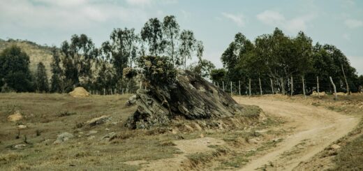
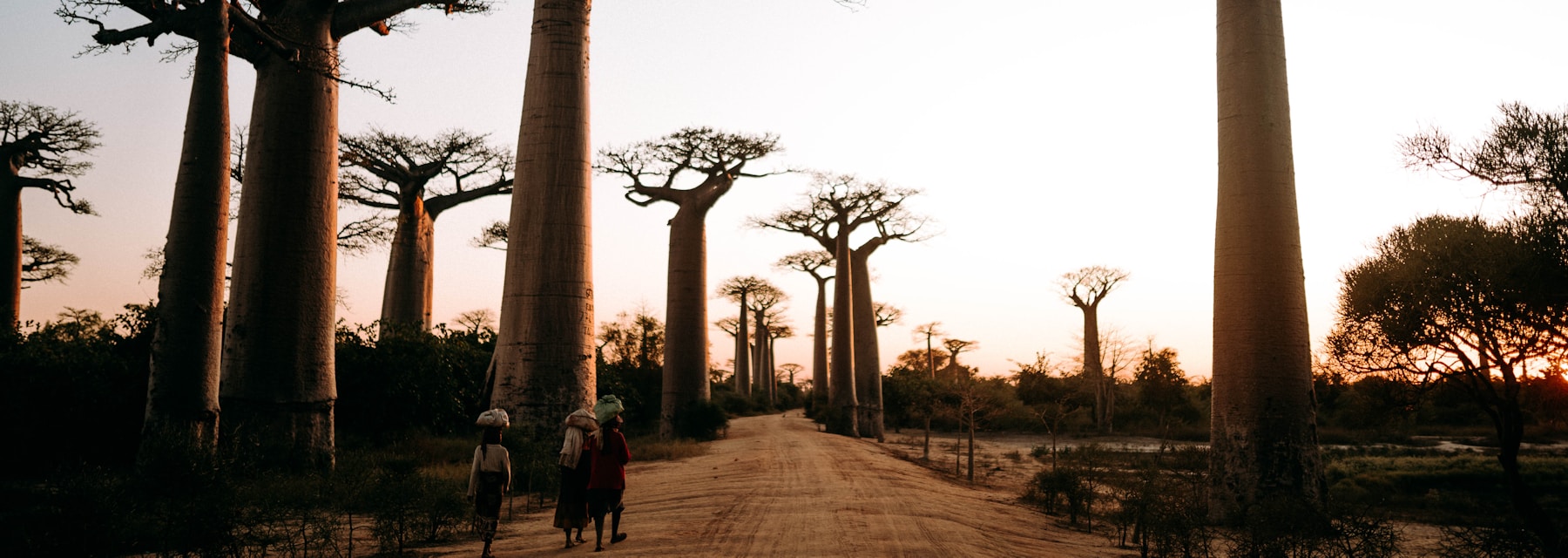
The 230-kilometre final stage from Betroka through Tsivory to Fort Dauphin is the most remote section of the RN13 and the most scenically rewarding. The road passes through extraordinary spiny forest — an ecosystem found nowhere else on Earth — and crosses several seasonal rivers before descending toward the Indian Ocean coast. Allow 8–10 hours for this stage and depart no later than 6:30 AM.
Tsivory is the only reliable fuel stop between Betroka and Fort Dauphin, and supply is not guaranteed — arrive with a full tank from Betroka. The approach to Fort Dauphin crosses the Anosy Mountains, which provide a dramatic descent into the coastal city. Fort Dauphin (Tôlanaro) has comfortable hotels, restaurants, and the spectacular Lokaro Peninsula and Berenty Reserve within day-trip distance.
Book your Fort Dauphin accommodation before departure: check availability on Agoda for Fort Dauphin hotels — Chez Jacqueline and Le Dauphin are popular with overland travelers and book up in peak season. For the full planning picture, see our 10-day Madagascar itinerary guide which includes the southern circuit as an option.
Ready to book your Madagascar trip?
Frequently Asked Questions
Do I need a 4WD for the RN13?
Yes, without exception. The Ihosy-to-Fort Dauphin section is laterite and sandy piste. A standard saloon or low-clearance SUV will bottom out or become stuck. A Toyota Hilux or Land Cruiser with high clearance and 4WD is the minimum.
How many days does the full RN13 take?
Three to five days of driving from Fianarantsoa to Fort Dauphin in dry season. This assumes 6–8 hour driving days and overnight stops at Ihosy, Betroka, and Tsivory.
Can I drive the RN13 in the wet season (November to April)?
Not reliably. River crossings become dangerous and some sections flood completely. Most operators close the southern corridor from December to March. May and October are shoulder-season options with some risk.
Is mobile phone coverage available on the RN13?
Coverage is patchy south of Ihosy and absent in the deep desert sections. Download offline maps and carry a satellite communicator or personal locator beacon (PLB) for emergencies on the Betroka–Fort Dauphin section.
The RN13 is not a route to attempt casually, but it is one of the most genuinely extraordinary road journeys available to travelers anywhere in Africa. The southern desert, the spiny forest, and the sheer remoteness of the Betroka–Fort Dauphin section create an experience that no guided tour or domestic flight can replicate. Prepare your vehicle, plan fuel stops obsessively, and never push into darkness. Compare 4WD hire options for the RN13 on Carla — book well ahead for dry season departures in June and July.
The RN13 crosses some of the most remote terrain in Madagascar. Medical evacuation from this corridor can cost $50,000–$80,000 USD. Get SafetyWing before you leave Fianarantsoa — emergency evacuation coverage starts from $1.82/day and is active on remote routes.
Start planning your Madagascar adventure today
Browse Madagascar experiences on GetYourGuide
Affiliate link – commission earned at no extra cost to you.
Plan Your Trip to Madagascar
- Read the full Madagascar Travel Guide
- Explore itineraries by style and duration
- Explore the full destination guide
Where to Stay