Trekking Pic Boby & Andringitra 2026: Routes, Difficulty & What to Expect
Affiliate disclosure: This article contains sponsored links to hotels, tour operators, insurance providers, and other travel services. We earn a small commission if you book through our links, at no extra cost to you.
Trekking Pic Boby & Andringitra 2026 — At a Glance
- The summit: Pic Boby (Imarivolanitra), at approximately 2,658 m, is the highest trekkable peak in Madagascar — a moderate-to-strenuous multi-day hike rather than a technical climb.
- Best season: the cool, dry months from roughly April/May to October/November, when trails are firm and skies clearest; nights can drop near freezing year-round at altitude.
- Guided treks: compare guided treks on GetYourGuide for the classic Namoly-valley summit route and shorter circuits.
- Plan with a local: contact Carla to build a tailored Andringitra trek around your fitness, dates and budget.
- Getting to the trailhead: arrange a reliable car & driver via Carla for the long road from Ambalavao up to the park.
- Flight delays: if a flight to Madagascar is delayed or cancelled, you may be owed compensation — check your claim with AirAdvisor.
- Travel insurance: high-altitude trekking makes cover essential — SafetyWing Nomad Insurance is built for long-haul, adventurous trips.
- Where to sleep: book lodges near the park on Agoda for the nights before and after your trek.
- Guide rule: an official Madagascar National Parks (MNP) guide is compulsory inside Andringitra — porters and camping support are easy to add.
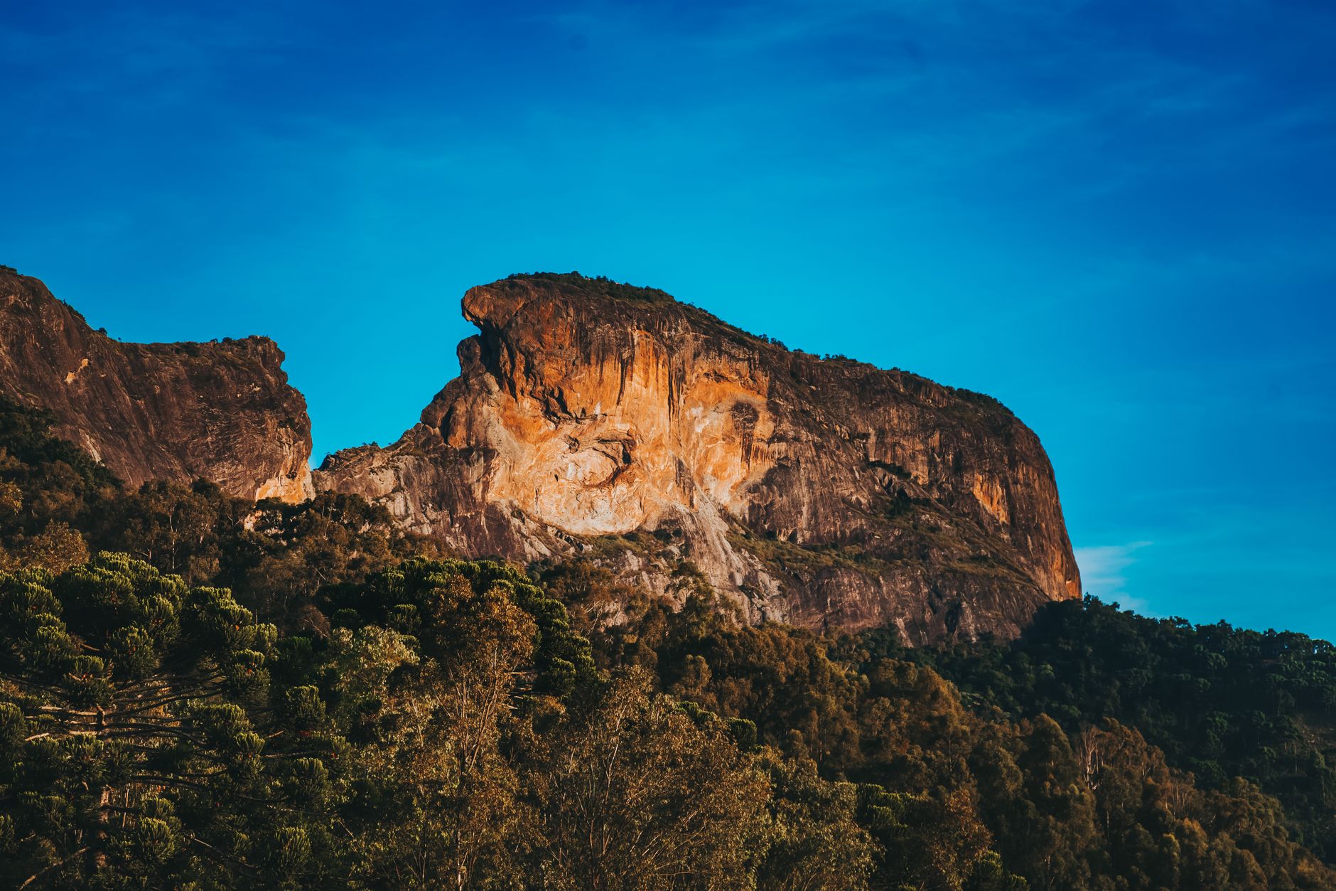
Few hikes in the Indian Ocean reward you the way the Pic Boby trek does. Tucked into the granite heart of southern Madagascar, Andringitra National Park rises in a series of dramatic domes, plateaus and waterfalls toward Pic Boby — known in Malagasy as Imarivolanitra, “close to the sky.” At roughly 2,658 metres it is the highest summit you can reach on foot in the country, and standing on its bare granite crown at dawn, watching the first light spill across an ocean of cloud and rock, is one of the great mountain experiences in Africa. This is not a peak for ropes and carabiners; it is a long, lung-stretching walk that rewards anyone with reasonable fitness and a respect for the cold.
This guide walks you through everything you need to plan the trek: the classic two-to-three-day route up from the Namoly valley, how hard it really is, the shorter day-hikes for those who would rather skip the summit, the granite walls of the Tsaranoro side, and the practicalities of guides, porters, weather and what to pack. Whether you are a seasoned hillwalker or simply an adventurous traveller looking for the most spectacular trek Madagascar can offer, Andringitra deserves a serious place on your itinerary. For the bigger picture, pair this with our complete Andringitra National Park guide and our broader Madagascar trekking and hiking guide.
Pic Boby (Imarivolanitra): the roof of trekkable Madagascar
Pic Boby sits at approximately 2,658 metres, making it the second-highest mountain in Madagascar overall — only the volcanic massif of Maromokotro in the far north (around 2,876 m) stands taller, and that peak is far more remote and rarely climbed. What sets Pic Boby apart is that it is genuinely walkable: there is a clear, guided route to the top that requires stamina and warm clothing rather than mountaineering skills. The summit itself is a smooth, weathered granite dome, swept by wind and often dusted with frost in the early morning. From the top the view is enormous and humbling — folded ranges fading into haze, the broad Namoly valley below, and on clear days a sense that you can see a good slice of the southern highlands at once.
The classic reason to make the effort is sunrise from the summit. Most itineraries time the final push so you reach the crown of Pic Boby in the dark and arrive as the sun breaks the horizon. The temperature can be brutally cold at that hour, but the payoff — watching warm light flood across the granite and burn off the valley mist — is unforgettable and, for many trekkers, the single highlight of their entire Madagascar trip. It is the kind of moment that makes the cold camp and the pre-dawn start instantly worthwhile.
The classic multi-day trek from the Namoly valley
The most popular and accessible way to climb Pic Boby starts from the Namoly valley on the eastern side of the park, reached by a long and bumpy road from the small town of Ambalavao. Most operators run the summit as a two- or three-day trek, and the extra day makes a real difference to both comfort and your chances of a clear summit.
Day one — ascent to a high camp
The first day typically climbs steadily out of the valley, through changing vegetation — montane forest giving way to open, rocky grassland and the strange, sparse high-altitude flora that thrives up here. Expect several hours of walking with a sustained uphill gradient; distances are modest in kilometres but feel longer because of the climb and the thinning air. You normally reach a high camp in the late afternoon, pitched on the plateau within striking distance of the summit, where the temperature drops sharply as the sun sets.
Day two — dawn summit and descent
The summit push usually begins in darkness, often a couple of hours before sunrise, so you reach the top of Pic Boby for first light. The final section is steep in places but non-technical — careful walking on rock and grass rather than scrambling. After the summit you descend back to camp or all the way down to the trailhead, depending on your itinerary. A three-day version spreads this out more gently, sometimes adding extra time on the high plateau, at the waterfalls, or to enjoy the natural pools lower down. Treat all distances and walking times as approximate — they vary with the route chosen, the weather and the pace of your group — and let your guide set the rhythm.
Difficulty and fitness: who the trek suits
Honest framing matters here. The Pic Boby trek is best described as moderate-to-strenuous. There is no technical climbing and no exposure that requires ropes, so you do not need mountaineering experience. What you do need is solid general fitness, the ability to walk uphill for several hours over uneven terrain on consecutive days, and a tolerance for cold and altitude. At roughly 2,658 metres the air is noticeably thinner than at sea level, and combined with cold nights and early starts this can sap energy faster than expected.
The trek suits reasonably active travellers, regular hillwalkers and adventurous first-timers who are willing to train a little beforehand. It is less suited to anyone with significant mobility issues, untreated heart or breathing conditions, or who is uncomfortable camping in genuinely cold conditions. If in doubt, choose the three-day option, walk at a steady pace, and tell your guide honestly about your fitness so they can adjust the plan. For context on how this fits alongside other big Madagascar adventures, see our guide to the best Madagascar adventure travel.
Shorter day-hikes and other circuits
You do not have to summit Pic Boby to enjoy Andringitra. The park is laced with shorter circuits that are spectacular in their own right, and they are perfect for travellers who would rather not commit to a high-altitude camp. Popular options include walks to the park’s waterfalls and natural swimming pools, where you can cool off in clear granite-fed water, and day routes that climb onto the lower edges of the high plateau for huge views without the full summit effort.
These shorter hikes range from gentle half-day strolls to demanding full days, so there is something to match almost any fitness level. They also make an excellent acclimatisation day if you do plan to attempt Pic Boby later in your stay. If you are building a longer base in the area, it is worth checking where to stay near Andringitra so you can spread your walking across several days rather than rushing everything into one trip.
The Tsaranoro side: granite walls, trekking and climbing
Andringitra has two very different faces. The Namoly valley is the gateway for the Pic Boby trek; on the other side lies the Tsaranoro valley, famous for its sheer granite walls that soar hundreds of metres straight up from the plain. Tsaranoro is a magnet for walkers who want dramatic scenery — gentle valley trails, viewpoints beneath the cliffs, and rewarding hikes among sacred forests — as well as for serious rock climbers drawn to some of the most impressive big-wall routes in the southern hemisphere.
If your trip leans toward vertical adventure rather than (or as well as) the Pic Boby summit, the Tsaranoro walls are world-class. We cover the harder side of that experience in detail in our dedicated rock climbing in Madagascar — Tsaranoro Valley and Andringitra guide. Many travellers combine a few relaxed days exploring the Tsaranoro side with the Pic Boby trek for a complete Andringitra experience.
Guides, porters and camping logistics
Inside Andringitra, an official Madagascar National Parks (MNP) guide is compulsory — you cannot trek the summit route independently. This is a good thing: a guide handles route-finding, timing the dawn summit, reading the weather, and ensuring you tread lightly on a fragile environment. Park entry fees are paid at the MNP office, and your guide and any local arrangements are organised through the park or your operator.
For the multi-day trek you will also want porters to carry camping gear, food and water to the high camp, which makes a huge difference to how much you enjoy the walking. Camping is the norm at altitude, with tents pitched on the plateau; some operators provide all the equipment, while others expect you to bring your own sleeping bag. Sorting this out in advance avoids unpleasant surprises. The simplest approach is to let a trusted local fixer assemble the whole package — guide, porters, transport and camping — which is exactly what Carla can arrange. For ready-made options, browse Andringitra tour packages and get a sense of the typical Andringitra trip cost before you commit.
Weather and altitude: expect the cold
The single most underestimated aspect of trekking Andringitra is the cold. This is high-altitude terrain in the Malagasy highlands, and even in the dry season nights at the high camp can drop to near freezing — frost on the tents at dawn is common. The best window for trekking is the cool, dry season, roughly April/May to October/November, when rain is least likely and the trails are firm. Outside that window, paths can become muddy and slippery, and cloud often hides the summit views you came for. For a wider seasonal overview across the country, see our guide to the best time to visit Madagascar.
Altitude itself is rarely dangerous at Pic Boby’s height for healthy walkers, but it does make the air thinner and the effort harder, so pacing matters. Combine the cold, the early starts and the climbing, and you have a trek that demands warm layers and sensible energy management far more than raw speed.
What to pack for Pic Boby
Packing well is the difference between a magical trek and a miserable one. The non-negotiables are:
- Sturdy hiking boots with good grip and ankle support — the terrain is rocky and uneven.
- Warm layers — fleece, an insulated jacket, hat and gloves for the freezing summit dawn.
- Waterproof and windproof shell — weather can change quickly on the plateau.
- A sleeping bag rated for cold if your operator does not provide one — this is critical for the high camp.
- A headtorch with spare batteries for the pre-dawn summit start.
- Plenty of water plus a way to treat refills, and high-energy snacks.
- Strong sun protection — at altitude the UV is intense even when the air is cold; bring sunscreen, sunglasses and a sun hat.
- Trekking poles (optional but helpful for the long descent) and a small daypack for summit day.
Layering is the golden rule: you will be hot on the climb and bitterly cold at the top, sometimes within the same hour.
Safety, acclimatisation and responsible trekking
Trek sensibly and Andringitra is a safe, rewarding mountain. Walk at a steady pace, drink regularly, and listen to your guide’s timing for the summit push. If you have arrived recently from sea level, an easy day-hike beforehand helps you settle into the altitude and the effort. Tell your guide immediately if you feel unwell, unusually breathless or hypothermic, and never push for the summit if conditions or your body say otherwise — the mountain will still be there next time.
Responsible trekking matters as much as personal safety. Andringitra protects rare endemic plants and a fragile high-altitude ecosystem, so stay on marked paths, carry out all your rubbish, and respect any sacred or restricted areas your guide points out. Because high-altitude trekking carries inherent risk, comprehensive travel insurance is essential — make sure your policy covers hiking at this elevation and any evacuation you might need.
Scenery and wildlife along the way
Andringitra is as much a feast for the eyes as a workout for the legs. The trek climbs through a remarkable range of landscapes in a single day: lush montane forest at the bottom, open rocky grassland in the middle, and the bare, sculpted granite of the high plateau near the top. Endemic plants cling to the rock at altitude, including curious cushion species and flowering plants found almost nowhere else, and the granite vistas — domes, ridges and sheer faces glowing in the morning light — are simply spectacular.
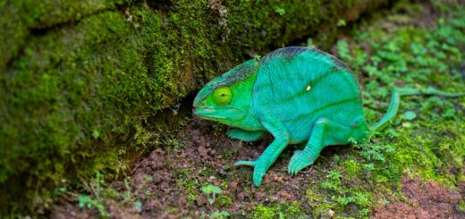
Wildlife is part of the magic too. The lower forests and surrounding reserves are home to ring-tailed lemurs and other lemur species, and birdlife is varied along the route. While Andringitra is more about mountains than mammals, the chance of spotting lemurs on the approach adds a distinctly Malagasy flavour to a trek that already feels like nowhere else on Earth.
Getting There & Travelling Well
Reaching Andringitra usually means flying into Antananarivo and then travelling overland south toward Ambalavao before the rough final road up to the park. If your flight into Madagascar is delayed, overbooked or cancelled, you may be entitled to compensation — it takes only a moment to check your claim with AirAdvisor, and a successful claim can quietly fund a good chunk of your trek.
For a trip that involves cold nights at altitude, remote trails and long road transfers, proper travel insurance is not optional. SafetyWing Nomad Insurance is designed for exactly this kind of long-haul, adventurous travel, with flexible cover that suits trekkers and long-term explorers alike. Before you set foot on the trail, take a few minutes to sort your SafetyWing cover and confirm it includes high-altitude hiking and emergency evacuation — peace of mind that lets you focus entirely on the mountain.
Let Carla plan your Andringitra trek
Organising a Pic Boby trek from abroad — guide, porters, camping, park fees and the long transfer from Ambalavao — is far easier with someone on the ground. Carla is our trusted local contact in Madagascar, and she can put together a complete Andringitra trek tailored to your dates, fitness and budget, from a relaxed plateau circuit to the full dawn summit. She can also arrange a comfortable car & driver via Carla for the journey to and from the trailhead, so you arrive rested and ready to walk.
Frequently Asked Questions
How hard is the Pic Boby trek?
It is best described as moderate-to-strenuous. There is no technical climbing, so you do not need mountaineering skills — but you do need solid general fitness to walk uphill for several hours over rocky terrain on consecutive days, plus a tolerance for cold and altitude at roughly 2,658 m. Reasonably active travellers and regular hillwalkers manage it well, especially over three days.
How many days does it take?
Most people climb Pic Boby on a two- or three-day trek from the Namoly valley. The two-day version is more intense; the three-day option is gentler, gives you a better chance of a clear summit, and leaves time to enjoy the waterfalls and high plateau. Exact timings vary by route, weather and group pace, so treat any schedule as approximate.
Do I need a guide?
Yes. An official Madagascar National Parks (MNP) guide is compulsory inside Andringitra — you cannot trek the summit route alone. A guide handles route-finding, summit timing, weather calls and conservation rules, and you can easily add porters and camping support. The simplest way to organise everything is through a trusted local fixer such as Carla.
What is the best season for trekking Andringitra?
The cool, dry season — roughly April/May to October/November — is best, with firmer trails, clearer summit views and less rain. Outside that window paths can turn muddy and cloud often hides the views. See our best time to visit Madagascar guide for the wider picture.
How cold does it get?
Very cold at altitude, especially at night and at dawn on the summit. Temperatures at the high camp can drop to near freezing year-round, and frost on the tents is common. Warm layers, a cold-rated sleeping bag and a windproof shell are essential — the summit sunrise is freezing even in the dry season.
Ready to stand on the roof of Madagascar?
From the dawn summit of Pic Boby to the granite walls of Tsaranoro, Andringitra is the trek of a lifetime — and it is far easier with a local expert handling the details. Contact Carla to plan a tailored Andringitra trek around your fitness and dates, and add a reliable car & driver via Carla for the journey to the trailhead. Then browse lodges near the park on Agoda for the nights either side of your climb.
Plan Your Trip to Madagascar
- Read the full Madagascar Travel Guide
- Explore itineraries by style and duration
- Explore the full destination guide
Where to Stay