Natural Disaster Risk in Madagascar 2026: Earthquakes, Floods and Cyclone Zones
This post contains affiliate links. We may earn a small commission at no extra cost to you.

At a Glance
- Cyclones: December 15 to mid-April peak season — east coast most affected
- Earthquakes: Very low — Madagascar sits on a stable craton, major seismic events rare
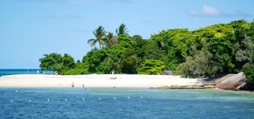
- Flooding: Significant in rainy season (Nov-Apr) — coastal east and lowlands at highest risk
- Drought (south): Multi-year droughts in Androy and Anosy regions — affecting Fort Dauphin overland access
- Stay in safe-zone hotels: Compare highland Tana options on Agoda
- Disaster-aware tours: Browse on GetYourGuide
- Cyclone-coverage insurance: SafetyWing covers natural disaster disruption
Madagascar’s natural disaster risk profile is dominated by tropical cyclones; everything else is secondary. Earthquakes are essentially absent thanks to the country’s position on the stable East African craton. Flooding follows the cyclone season closely. Drought affects the deep south but does not directly threaten tourists. This guide breaks down each risk category by region, the practical travel implications, and how to plan around them in 2026.
Cyclones — The Dominant Natural Disaster Risk
Madagascar’s cyclone season runs December 15 through approximately April 15, with peak intensity in January-February. Tropical depressions form in the southwest Indian Ocean and track westward, with major landfalls historically averaging 1 to 3 per year. The east coast (Toamasina, Sainte-Marie, Maroantsetra, Antalaha) is directly in the impact zone for nearly all landfalls. The northeast coast (Diego Suarez area) sees periodic impacts. The west coast (Mahajanga, Morondava, Toliara) sees indirect effects (heavy rain, rough seas) but rare direct landfalls. The highlands (Antananarivo, Antsirabe, Fianarantsoa) experience downgraded systems with significant rainfall but no destructive winds.
For 2026 travelers: any east coast destination (Sainte-Marie, Toamasina, Masoala) should be avoided December 15 through mid-April. Nosy Be can be visited via flight in this window but Sainte-Marie ferry service is unreliable. Tsingy de Bemaraha access is closed entirely (road impassable). The central highlands route (Tana through RN7 to Toliara) operates normally in cyclone season — heavy afternoon rain is the main inconvenience. Major historical reference points: Cyclone Idai (March 2019) caused significant infrastructure damage; Cyclone Batsirai (February 2022) hit Mahanoro on the east coast with major impact. Monitor Meteo Madagascar updates for active systems during travel. SafetyWing’s natural disaster coverage handles cyclone-related trip interruption when activated before the policy date framework.
Earthquakes — Genuinely Low Risk
Madagascar sits on the stable East African craton, away from the major plate boundaries that drive seismic activity in East Africa (the Great Rift system). The result: earthquake risk is genuinely among the lowest in Africa. Minor seismic events (magnitude 3 to 4) occur occasionally in the central highlands but are rarely felt by tourists. The last destructive earthquake in Madagascar was the 1985 Antananarivo M5.5 event, which caused minor structural damage to older buildings but no major casualty incident.
For travelers: no specific earthquake-preparation protocol is needed. Hotels in modern construction (most mid-range and luxury properties built since 2000) meet basic seismic resilience standards. Older heritage properties in the upper-town Tana zones (La Varangue, La Maison Gallieni) are pre-1900 construction but have undergone retrofit work. Activity-related risks (caves, via ferrata at Tsingy, multi-day treks at Andringitra) involve no significant earthquake exposure. This is one of the structural advantages Madagascar enjoys versus East African mainland destinations. Compare modern construction hotels on Agoda for travelers prioritizing earthquake safety, though the risk differential between options is minimal.
Flooding — Significant in Rainy Season Across Multiple Regions
Flooding affects multiple Madagascar regions during the rainy season (November through April). The most affected zones: east coast lowlands (Toamasina region), the Pangalanes Canal corridor, the Mahanoro and Mananjary watersheds, and the northeast (Sambava, Antalaha, Maroantsetra) which is also cyclone-prone. The west coast Mahajanga area sees periodic Betsiboka river flooding. Antananarivo experiences localized flooding in the lower-town districts (Anosibe, the Ikopa River margins) during heavy rain events; the upper town is not affected.
Road flooding has direct travel implications. The Morondava-Bekopaka road for Tsingy de Bemaraha is impassable December through March. RN7 sections through Behenjy, Antanifotsy and Ihosy can be temporarily cut by heavy rain — typically 6 to 24 hours of closure. The RN5A from Tana to Soanierana-Ivongo (ferry port for Sainte-Marie) has flood-vulnerable segments around Anjozorobe and Andilamena. For cyclone-season travel, build 1 to 3 day buffer days into any overland routing and avoid the most flood-prone routes. Compare 4WD rentals on Carla — proper 4WD vehicles can handle some flooded segments that standard cars cannot.
Drought and Other Regional Risks
Southern Madagascar (Androy, Anosy and parts of Atsimo-Andrefana regions) has experienced multi-year drought conditions since around 2018, with significant humanitarian impact on Malagasy communities. For tourists, the drought primarily affects overland routes to Fort Dauphin (the RN13 from Ihosy crosses drought-affected territory) and access to Anakao south of Toliara. Hotel and tourist infrastructure in Fort Dauphin and Toliara continues to operate normally; the drought does not directly threaten tourist safety but is a structural issue worth understanding.
Other regional risks: occasional plague outbreaks (typically September-April, primarily affecting the central highlands rural areas — extremely rare in tourist contexts and managed by Ministère de la Santé); periodic chikungunya and dengue outbreaks in coastal urban areas (Tana, Toamasina, Mahajanga); and seasonal Rift Valley fever cases in livestock areas (not generally affecting tourists). For travel insurance purposes, these are categorized under “epidemic and pandemic events” and coverage varies by policy. SafetyWing’s standard Nomad Insurance excludes pandemic-declared events but covers individual disease incidents at the standard medical evacuation tier. Confirm SafetyWing coverage limits for the region you are visiting.
Travelers with chronic conditions should plan for evacuation contingencies — cyclones and floods regularly close roads for 2 to 7 days. Pack extra medication and self-monitoring kits; Sinocare ships glucose monitors and CGMs internationally if you need a backup unit.
Frequently Asked Questions
Should I cancel my Madagascar trip if a cyclone is forecast?
Depends on timing and your itinerary. If a named cyclone is forecast to make landfall within your travel window and your itinerary includes east coast or Tsingy, cancellation or rescheduling is reasonable. For highland-only itineraries (Tana, Antsirabe, Fianarantsoa, Ranomafana), most cyclones cause delays and rain but not trip-ending disruption. Check Meteo Madagascar 5 to 10 days before departure.
Are earthquakes really not a risk in Madagascar?
Correct — Madagascar’s geological position on the East African craton means earthquake risk is structurally low. The last destructive seismic event was 1985. Modern hotel construction is fully adequate. This contrasts sharply with East African mainland destinations along the Great Rift system.
Can I get cyclone-related insurance coverage if a cyclone is already forecast at booking?
Generally no — most travel insurance policies have a ‘known event’ exclusion. If a named cyclone is already forecast when you buy the policy, that specific event is excluded. Buy insurance well before any cyclone is on the radar; SafetyWing’s monthly subscription model means you can activate it months ahead of any travel.
Is the southern drought a tourism safety issue?
Indirectly. The drought affects Malagasy communities in Androy and Anosy regions significantly but does not directly threaten tourist safety in Fort Dauphin or Toliara hotels and parks. Tourists should be aware of the humanitarian context and consider supporting local conservation and community organizations that work in the drought-affected south.
Madagascar’s natural disaster risk profile is dominated by tropical cyclones — the only category that meaningfully affects tourist travel plans. Earthquakes are essentially absent, flooding is cyclone-correlated, and the southern drought is a humanitarian issue rather than a tourist safety threat. Plan around cyclone season for east coast and Tsingy itineraries; everything else operates with normal precautions. Before booking, activate SafetyWing cover from 1.82 USD per day well in advance of any cyclone forecast — the natural disaster coverage applies when activated before the named event.
Travel Insurance for Madagascar
Medical evacuation from Madagascar costs $30,000–$80,000. Don’t travel without cover.
- SafetyWing — Best for budget travelers and long stays. From $1.82/day.
- World Nomads — Best for adventure activities: trekking, diving, motorbikes.
Plan Your Trip to Madagascar
- Read the full Madagascar Travel Guide
- Explore itineraries by style and duration
- Explore the full destination guide
Where to Stay