Andringitra National Park 2026: The Complete Guide to Madagascar’s Granite Mountains
Affiliate disclosure: This article contains sponsored links to hotels, tour operators, insurance providers, and other travel services. We earn a small commission if you book through our links, at no extra cost to you.
Andringitra National Park 2026 — At a Glance
- What & where: A dramatic granite massif in Madagascar’s south-central highlands (Haute Matsiatra region), reached via the town of Ambalavao off the RN7 — one of the island’s premier trekking and mountain destinations.
- Best time: The dry season (roughly April/May to October/November) for trekking — skies are clear and trails are safe, but nights at altitude are genuinely cold, so pack warm layers.
- The big draw: Pic Boby (Imarivolanitra, ~2,658 m) — the highest summit you can actually hike in Madagascar, usually a multi-day trek with a sunrise finish.
- Treks & tours: Browse guided options on Andringitra treks & tours on GetYourGuide.
- Plan with a local: contact Carla to build a tailored Andringitra itinerary around your dates and fitness.
- Getting around: Andringitra is remote — arrange a reliable car & driver via Carla for the RN7 and the rough access roads.
- Flight delays: If a delayed or cancelled flight disrupts your trip, check your compensation with AirAdvisor.
- Travel insurance: High-altitude trekking calls for proper cover — SafetyWing Nomad Insurance.
- Where to stay: Compare lodges & bases near the park on Agoda.
If you imagine Madagascar and picture only baobabs, rainforests and ring-tailed lemurs, Andringitra National Park will reset everything you thought you knew about the island. This is Madagascar’s high country: a vast amphitheatre of granite peaks, windswept plateaus, plunging waterfalls and natural rock pools, where the air turns crisp, frost can silver the grass at dawn, and the trails climb towards the highest accessible summit in the country. For trekkers, climbers and anyone who travels best with mud on their boots, Andringitra is one of the most rewarding — and least crowded — corners of the island.
This complete guide walks you through everything you need to plan a trip: where Andringitra is and how to reach it, what the landscape and ecosystems are really like, the famous Pic Boby trek, the climbing mecca of the Tsaranoro Valley, the wildlife you’ll meet, the nearby Anja Community Reserve, when to go, where to stay, what it costs, and how it slots neatly into a southern Madagascar route along the RN7. By the end you’ll know whether Andringitra belongs on your itinerary — and exactly how to make it happen.
What & Where Is Andringitra National Park?
Andringitra National Park protects a granite mountain massif in Madagascar’s south-central highlands, within the Haute Matsiatra region. The usual gateway is the small, characterful town of Ambalavao, which sits roughly 56 km south of Fianarantsoa just off the RN7 — the country’s main north–south artery. From Ambalavao, side roads (often rough, frequently requiring a 4×4) branch off towards the park’s two main access points: the Namoly valley on the eastern side for trekking, and the Tsaranoro valley on the western side for climbing and valley walks.
The area has been protected for a long time by Madagascar standards: it was first set aside as a reserve in 1927 and became a national park in 1999, managed today by Madagascar National Parks (MNP). The park covers more than 31,000 hectares of mountain terrain, ranging from low-elevation rainforest on its damp eastern flanks up to bare granite summits and high-altitude grassland. That sheer spread of altitude — from warm, humid forest to cold, exposed plateau — is what makes Andringitra so unusual and so spectacular.
For the wider context of how Andringitra compares with the island’s other protected areas, see our guide to Madagascar’s best national parks and reserves.
The Landscape & Ecosystems
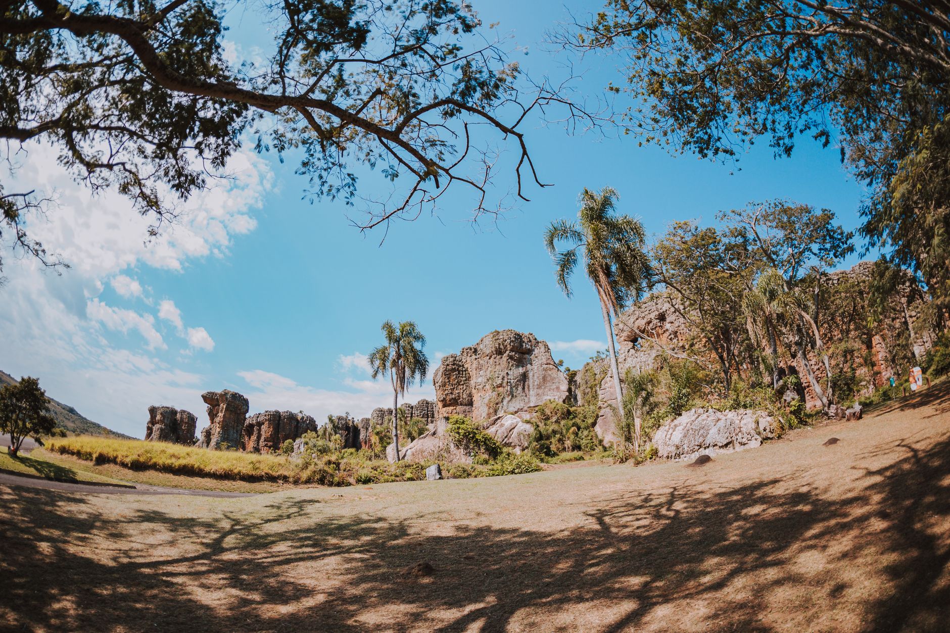
Andringitra’s signature is granite — enormous domes, slabs and pinnacles that rise in sheer walls and rounded summits above the highlands. Between the peaks lie high plateaus dotted with tarns and natural swimming pools, while seasonal streams tumble off the rock as waterfalls. The scale is genuinely alpine, and on a clear day the views stretch for tens of kilometres across ridge after ridge of the highlands.
What makes the park scientifically remarkable is that it spans roughly three ecosystems stacked by altitude. Lower down, on the wetter eastern side, you walk through humid rainforest. Higher up, the forest thins into transitional woodland and montane vegetation. Higher still, you emerge onto open high-altitude grassland and bare rock, where the plants are tough, low and specialised — endemic high-altitude flora including hardy aloes, cushion plants and lichens that cling to the granite. It is one of the very few places in Madagascar where you can experience genuine cold: nights near the summits can drop towards freezing, and frost is a real possibility in the cool season, something most visitors never associate with this tropical island.
Pic Boby (Imarivolanitra) — Madagascar’s Highest Trekkable Summit
The headline of Andringitra is Pic Boby, known by its Malagasy name Imarivolanitra, rising to about 2,658 m. It is the highest summit in Madagascar that ordinary travellers can actually reach on foot — no technical climbing required, just stamina, good legs and a head for early starts. (For the record, the island’s outright highest point is Maromokotro in the remote Tsaratanana massif, at roughly 2,876 m, but that peak is not a tourist trek and sees very few visitors.)
The classic route starts from the Namoly valley on the eastern side and is typically done over two to three days, camping en route. Most trekkers aim for a pre-dawn push to the summit so they reach the top for sunrise — and on a clear morning, watching the light spill across the granite and the cloud-filled valleys below is the kind of view you remember for life. Because the summit is high and exposed, weather can change fast and temperatures plummet, so warm clothing, a windproof layer and a good sleeping bag are essential.
If Pic Boby is your main reason for coming, read our dedicated Andringitra trekking and Pic Boby guide for the full route breakdown, fitness expectations and logistics. For trekking across Madagascar more broadly, see our Madagascar trekking and hiking guide.
The Tsaranoro Valley — Granite Walls & Rock Climbing
On the western side of the massif lies the Tsaranoro Valley, a place of almost surreal beauty. Sheer granite cliffs — some of the longest big-wall climbing routes in the world — rise straight out of a green valley floor dotted with lodges, terraced fields and a small sacred forest revered by local communities. It is a magnet for serious rock climbers, but you don’t need a rope to enjoy it: the valley offers superb day hikes, viewpoints over the cliffs, and a relaxed base for soaking up the scenery.
For climbers, the big walls of Tsaranoro and Andringitra are genuinely world-class. If technical climbing is what draws you, read our dedicated rock climbing in Madagascar — Tsaranoro Valley and Andringitra guide for routes, seasons and operators. For everyone else, Tsaranoro is simply one of the most photogenic valleys you’ll find anywhere in the country, and an easy place to spend a couple of restful days.
Wildlife of Andringitra
Andringitra is not a classic wildlife-watching park in the way of the eastern rainforests, but its fauna is fascinating precisely because it is adapted to altitude and cold. Most famously, the park is home to cold-adapted ring-tailed lemurs, which here live at higher and chillier elevations than almost anywhere else, with thicker coats to suit. Other lemur species inhabit the forested zones, and the park supports a range of highland birds and a wealth of endemic plants — the high-altitude flora is arguably as much of a draw as the animals.
If lemurs are high on your list, pair Andringitra with our wider guide on where to see lemurs in Madagascar, and consider the nearby Anja Community Reserve described below for guaranteed, close-up ring-tailed encounters.
Anja Community Reserve — Easy Lemurs & Granite Boulders
Just off the RN7 near Ambalavao, the Anja Community Reserve is a small, community-run reserve that makes a perfect companion to Andringitra. Tucked among dramatic granite boulders and cliffs, Anja is home to a habituated population of ring-tailed lemurs that are easy to find and wonderfully relaxed around visitors. A guided walk here is short and gentle — typically a half-day or less — making it ideal if you want guaranteed lemur sightings without a strenuous trek.
Because Anja is community-managed, your entrance fee directly supports the surrounding villages, making it one of the most rewarding stops on the southern route from both a wildlife and a responsible-travel perspective. Many travellers combine Anja with a day or two in Andringitra and a night in Ambalavao, and we strongly recommend doing the same.
The Trekking Experience & Circuits
Like all Madagascar national parks, Andringitra requires you to hire an official MNP guide — you cannot simply set off alone, and the rule exists for safety and conservation as much as anything. The good news is that the park offers an excellent range of options to suit different ambitions. At the gentle end are half-day and day hikes to waterfalls, viewpoints and natural pools. At the demanding end is the full multi-day traverse, including the Pic Boby summit, which involves camping at altitude and several long days on the trail.
Trails are well-established but rugged, with plenty of granite slabs, steep sections and exposed ridges. Porters can be hired to carry camping gear and food, which makes the longer treks far more enjoyable, and most multi-day itineraries include a cook so you eat well at camp. Whatever you choose, this is hiking that rewards a reasonable level of fitness and a sense of adventure — it is wilder and more physical than the gentle forest boardwalks of many other Madagascar parks.
When to Visit Andringitra
The clear winner for Andringitra is the dry season, roughly from April or May through to October or November. During these months the trails are dry and safe, river crossings are manageable, and the famous summit views are most likely to be clear. The trade-off is temperature: at altitude the nights are genuinely cold, frost is possible in the coolest months, and even sunny days can be breezy and chilly high up. Warm layers, a windproof jacket, a hat and gloves, and a proper sleeping bag for camping are non-negotiable.
The wet season (roughly November to March) brings rain, slippery rock, leeches in the forest zones, and a real risk of trails and access roads becoming impassable, so it is best avoided for serious trekking. For a fuller picture of seasonal trade-offs across the island, see our best time to visit Madagascar guide.
Getting There & Access
Andringitra sits off the beaten track even by Madagascar standards. The journey almost always runs along the RN7 to Ambalavao, the gateway town about 56 km south of Fianarantsoa. From Ambalavao, the two halves of the park are reached by separate, rough side roads: head east towards the Namoly valley for the trekking and the Pic Boby ascent, or west towards the Tsaranoro valley for climbing and valley walks. These access roads are unpaved and often badly rutted; a 4×4 is frequently needed, especially after rain.
Because of the rough roads and the remoteness, the simplest and most reliable approach is a private vehicle with an experienced driver who knows the route. You can arrange a dependable car & driver via Carla to handle the RN7 and the access tracks, so you arrive fresh and ready to walk. Andringitra also fits naturally into the wider southern Madagascar RN7 route, and the gateway city is covered in our Fianarantsoa guide.
Where to Stay
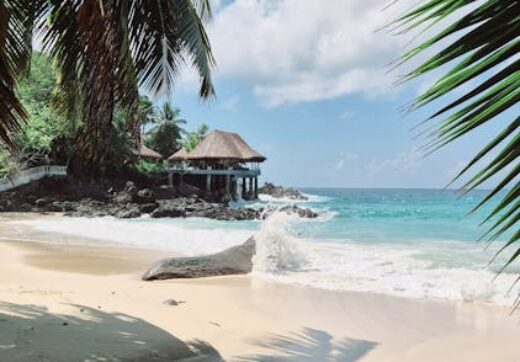
Accommodation around Andringitra ranges from simple camps and trekkers’ lodges in the Namoly valley to a cluster of more comfortable lodges in the Tsaranoro valley, plus hotels and guesthouses in Ambalavao for the night before or after your trek. On the mountain itself, multi-day treks mean camping, so much of your “where to stay” decision comes down to choosing a comfortable base on either side of the massif.
For a full breakdown of lodges, camps and bases, see our dedicated where to stay in Andringitra guide. You can also compare lodges & bases near the park on Agoda to lock in your accommodation around the area.
Fees & Practicalities
Visiting Andringitra involves several costs beyond getting there: an MNP park entrance fee, the mandatory guide fee, and — for multi-day treks — porters and a cook. Fees are set by Madagascar National Parks and can change, so always check current MNP fees before you travel rather than relying on older figures. Budget realistically for a guided, supported trek, and remember that tipping guides and porters is customary and much appreciated.
For a detailed look at what an Andringitra trip actually costs — from park fees and guides to transport, lodging and tours — see our Andringitra trip cost guide. If you’d rather have the whole thing organised end to end, browse Andringitra tour packages or compare options on GetYourGuide.
How Andringitra Fits an RN7 / Southern Trip
Andringitra is one of the great set-pieces of a southern Madagascar road trip. Travelling south along the RN7, most visitors string together Fianarantsoa, the rainforest of Ranomafana, the highland scenery, Ambalavao with Anja, and then either Andringitra for trekking or a continuation south towards Isalo and the coast. Because the park demands a few days and some effort, it works best for travellers who are building an active, outdoorsy leg into their southern route rather than racing through.
A natural pairing is the rainforest park of Ranomafana, which sits in the same southern cluster and offers wildlife and forest as a complement to Andringitra’s mountains and granite. Together, Ranomafana and Andringitra give you the full range of highland Madagascar — wet eastern forest and cold high peaks — within a single, well-planned loop.
Getting There & Travelling Well
Reaching Andringitra means flying into Madagascar and then a long overland journey down the RN7, so flight disruptions can have knock-on effects on a tightly planned trek. If your flight to or from Madagascar is delayed or cancelled, you may be entitled to compensation — check your eligibility with AirAdvisor and reclaim what you’re owed.
High-altitude trekking in a remote region is exactly the kind of trip where good travel insurance earns its keep. Andringitra is hours from major medical facilities, the weather can turn, and altitude adds its own risks, so make sure you’re covered before you set off. We use and recommend SafetyWing Nomad Insurance, which is built for long-term and adventurous travellers and is straightforward to set up. Whether you’re trekking Pic Boby or climbing in Tsaranoro, sort your SafetyWing cover before you leave home.
Suggested Andringitra Trip Plan
For travellers short on time or energy, a day-hike option works well: base yourself in the Tsaranoro valley or near Namoly, take a guided half-day or full-day walk to waterfalls, natural pools and viewpoints, and soak up the granite scenery without the demands of a summit push. Add a half-day at the Anja Community Reserve and a night in Ambalavao and you have a satisfying, low-intensity introduction to the area.
For the full experience, plan a two-to-three-day Pic Boby trek from the Namoly valley with camping, a guide, porters and a cook, timing the summit for a sunrise finish. Bookend it with a night in Ambalavao on the way in and the Anja reserve for easy lemurs on the way out, and you have a near-perfect outdoors leg on the RN7. Either way, build in buffer days — mountain weather and rough roads reward a flexible schedule.
Is Andringitra Worth Visiting?
Honestly, Andringitra is not for everyone — and that’s exactly its appeal. If your idea of a great trip is a comfortable lodge and short, flat forest walks, you’ll find the cold nights, rough roads and demanding trails hard work. But if you’re active, outdoorsy and happy to earn your views, Andringitra is one of the most rewarding places in all of Madagascar. The granite scenery is genuinely world-class, the Pic Boby sunrise is unforgettable, the trekking is wild and uncrowded, and the chance to combine it with Anja’s lemurs and the Tsaranoro cliffs makes it superb value for adventurous travellers. For anyone who travels best on their feet, it’s an emphatic yes.
Plan Your Andringitra Adventure with Carla
Andringitra rewards good planning — the right base, a reliable vehicle, the correct season and a trek matched to your fitness. Rather than piecing it together from afar, let a local handle the logistics. Contact Carla to design a tailored Andringitra itinerary, and arrange a dependable car & driver via Carla for the RN7 and the rough access roads so you arrive ready to walk.
Frequently Asked Questions
How high is Pic Boby and can anyone climb it?
Pic Boby (Imarivolanitra) reaches about 2,658 m and is the highest trekkable summit in Madagascar. No technical climbing skills are needed — it’s a strenuous but non-technical hike, usually done over two to three days with camping. A reasonable level of fitness and warm clothing are essential, as nights at altitude are cold.
What is the best time to visit Andringitra?
The dry season, roughly April or May to October or November, is best for trekking, with clear trails and the best summit views. Nights are cold at altitude and frost is possible, so pack warm layers. The wet season brings rain, slippery rock and possibly impassable access roads, so it’s best avoided for serious treks.
How do I get to Andringitra National Park?
You travel along the RN7 to Ambalavao, about 56 km south of Fianarantsoa, then take rough side roads — east to the Namoly valley for trekking, or west to the Tsaranoro valley for climbing. A 4×4 is often needed. The easiest approach is a private car and driver who knows the route.
Is Andringitra good for seeing lemurs?
The park is home to cold-adapted ring-tailed lemurs and other species, but for guaranteed, close-up sightings most travellers combine Andringitra with the nearby Anja Community Reserve near Ambalavao, where habituated ring-tailed lemurs live among the granite boulders and are easy to find on a short walk.
Do I need a guide and how much does it cost?
Yes — an official Madagascar National Parks (MNP) guide is compulsory, and for multi-day treks you’ll also hire porters and a cook. You pay an MNP entrance fee plus guide and porter fees. Costs change, so always check current MNP fees before you travel, and budget for tips, which are customary.
Ready to trek Andringitra?
Let a local handle the logistics so you can focus on the views. Contact Carla to plan a tailored Andringitra trip, and arrange a reliable car & driver via Carla for the journey. Compare guided treks & tours on GetYourGuide, find lodges near the park on Agoda, and protect your trip with SafetyWing Nomad Insurance.
Plan Your Trip to Madagascar
- Read the full Madagascar Travel Guide
- Explore itineraries by style and duration
- Best Tours and Guided Experiences
Where to Stay